Approximate Location Map
Large Map »
Latitude: 51.5495 / 51°32'58"N
Longitude: -1.1485 / 1°8'54"W
OS Eastings: 459137
OS Northings: 183742
OS Grid: SU591837
Mapcode National: GBR 91L.Y59
Mapcode Global: VHCYW.1BP0
Plus Code: 9C3WGVX2+QH
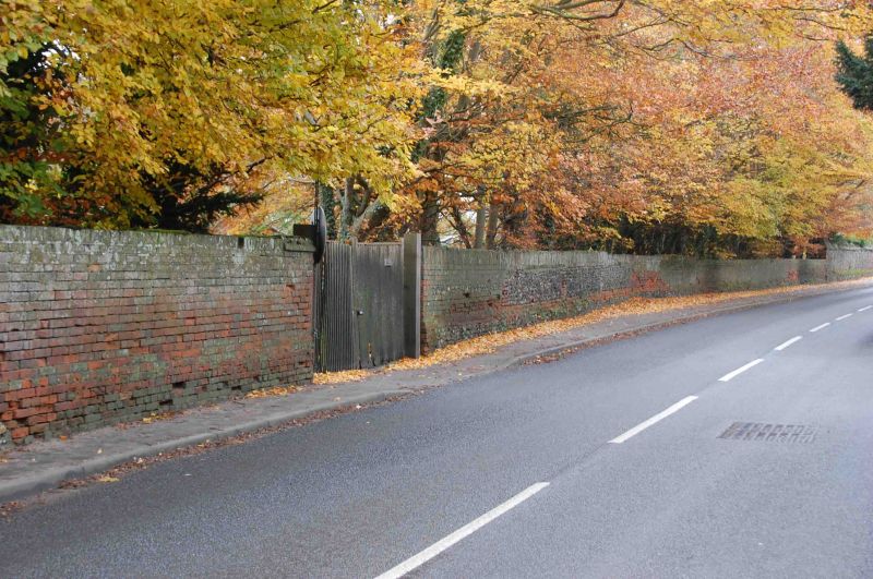
Entry Name: Wall to North Side of the Great House Meadow
Listing Date: 9 April 1952
Last Amended: 13 January 1986
Grade: II
Source: Historic England
Source ID: 1369099
English Heritage Legacy ID: 248009
ID on this website: 101369099
Location: Moulsford, South Oxfordshire, OX10
County: Oxfordshire
District: South Oxfordshire
Civil Parish: Moulsford
Built-Up Area: Moulsford
Traditional County: Berkshire
Lieutenancy Area (Ceremonial County): Oxfordshire
Tagged with: Wall
MOULSFORD THE STREET
SU5983
(East side)
10/125
Wall to north side of the
09/04/52
Great House Meadow
(Formerly listed as wall to
the Great Meadow)
GV
II
Wall. Late C18 with some rebuilding. Red brick. Included for group value.
Listing NGR: SU5913783742
External links are from the relevant listing authority and, where applicable, Wikidata. Wikidata IDs may be related buildings as well as this specific building. If you want to add or update a link, you will need to do so by editing the Wikidata entry.


Other nearby listed buildings
