Approximate Location Map
Large Map »
Latitude: 51.753 / 51°45'10"N
Longitude: -1.2592 / 1°15'33"W
OS Eastings: 451234
OS Northings: 206296
OS Grid: SP512062
Mapcode National: GBR 8Z4.0GJ
Mapcode Global: VHCXV.465G
Plus Code: 9C3WQP3R+68
Entry Name: Oxford Union Society Main Block
Listing Date: 29 January 1968
Grade: II*
Source: Historic England
Source ID: 1369445
English Heritage Legacy ID: 245867
ID on this website: 101369445
Location: Oxford, Oxfordshire, OX1
County: Oxfordshire
District: Oxford
Electoral Ward/Division: Carfax
Parish: Non Civil Parish
Built-Up Area: Oxford
Traditional County: Oxfordshire
Lieutenancy Area (Ceremonial County): Oxfordshire
Church of England Parish: Oxford St Michael and St Martin and All Saints
Church of England Diocese: Oxford
Tagged with: Architectural structure
SP 5106 SW 8/277C
1485
ST MICHAEL'S STREET (South Side),
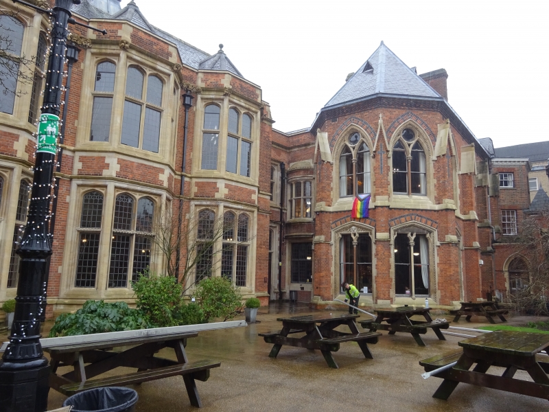
Oxford Union Society
Main Block
29.1.68.
II* GV
1864. By Thomas Deane. Venetian Gothic style. 2 storeys, 2-light windows.
The Union buildings form a group.
Listing NGR: SP5123406296
External links are from the relevant listing authority and, where applicable, Wikidata. Wikidata IDs may be related buildings as well as this specific building. If you want to add or update a link, you will need to do so by editing the Wikidata entry.


Other nearby listed buildings
