Approximate Location Map
Large Map »
Latitude: 55.4406 / 55°26'26"N
Longitude: -1.9704 / 1°58'13"W
OS Eastings: 401968
OS Northings: 616299
OS Grid: NU019162
Mapcode National: GBR G5PJ.6J
Mapcode Global: WHB03.PJW1
Plus Code: 9C7WC2RH+6R
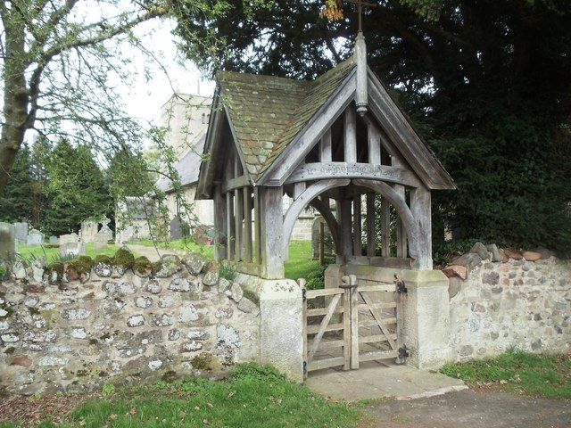
Entry Name: Lychgate 20 Yards East of Church of St Michael
Listing Date: 25 January 1985
Grade: II
Source: Historic England
Source ID: 1370872
English Heritage Legacy ID: 237540
ID on this website: 101370872
Location: Ingram, Northumberland, NE66
County: Northumberland
Civil Parish: Ingram
Traditional County: Northumberland
Lieutenancy Area (Ceremonial County): Northumberland
Church of England Parish: Ingram St Michael
Church of England Diocese: Newcastle
Tagged with: Lychgate
NU Ol NW INGRAM INGRAM
12/76 Lychgate 20 yards East of
Church of St. Michael
GV 11
Lychgate. c1920. Ashlar base, oak frame and local slate roof. Entrances formed of
arched tie beams on moulded curved braces, King and Queen posts above. Sides have
similar construction but with plain studs below the tie beam. Cross-gabled roof.
Listing NGR: NU0196816299
External links are from the relevant listing authority and, where applicable, Wikidata. Wikidata IDs may be related buildings as well as this specific building. If you want to add or update a link, you will need to do so by editing the Wikidata entry.


Other nearby listed buildings
