Approximate Location Map
Large Map »
Latitude: 52.63 / 52°37'47"N
Longitude: -2.4875 / 2°29'14"W
OS Eastings: 367102
OS Northings: 303690
OS Grid: SJ671036
Mapcode National: GBR BW.7G9X
Mapcode Global: WH9DG.R5P4
Plus Code: 9C4VJGH7+X2
Entry Name: 29, Church Hill
Listing Date: 9 August 1974
Grade: II
Source: Historic England
Source ID: 1374903
English Heritage Legacy ID: 362149
ID on this website: 101374903
Location: Ironbridge, Telford and Wrekin, Shropshire, TF8
County: Telford and Wrekin
Civil Parish: The Gorge
Built-Up Area: Telford
Traditional County: Shropshire
Lieutenancy Area (Ceremonial County): Shropshire
Church of England Parish: Ironbridge
Church of England Diocese: Hereford
Tagged with: Building
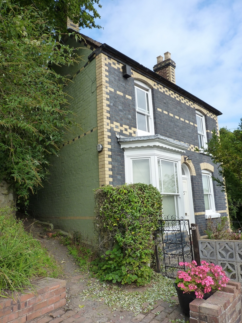
IRONBRIDGE CHURCH HILL
1.
5362 (north-east side)
No 29
SJ 6703 NW 15/290 9.8.74
II GV
2.
Mid C19. Blue brick front with dressings of yellow brick; 2 storeys; 2 sash windows
with cambered heads; 3-light canted bay to right of ground storey; doorway with
semi-circular head and plain fanlight; end gables and stacks; tiles.
Listing NGR: SJ6710203690
External links are from the relevant listing authority and, where applicable, Wikidata. Wikidata IDs may be related buildings as well as this specific building. If you want to add or update a link, you will need to do so by editing the Wikidata entry.


Other nearby listed buildings
