Approximate Location Map
Large Map »
Latitude: 53.7918 / 53°47'30"N
Longitude: -1.5334 / 1°32'0"W
OS Eastings: 430832
OS Northings: 432935
OS Grid: SE308329
Mapcode National: GBR BMN.4J
Mapcode Global: WHC9D.FY0H
Plus Code: 9C5WQFR8+PJ
Entry Name: Basin of New Dock Clarence Dock
Listing Date: 11 September 1996
Grade: II
Source: Historic England
Source ID: 1375061
English Heritage Legacy ID: 465941
Also known as: Clarence Dock
New Dock
ID on this website: 101375061
Location: Steander, Leeds, West Yorkshire, LS10
County: Leeds
Electoral Ward/Division: City and Hunslet
Parish: Non Civil Parish
Built-Up Area: Leeds
Traditional County: Yorkshire
Lieutenancy Area (Ceremonial County): West Yorkshire
Church of England Parish: Hunslet St Mary the Virgin
Church of England Diocese: Leeds
Tagged with: Dock Building complex Mixed-use development
LEEDS
SE3032NE CLARENCE ROAD
714-1/81/112 (South side (off))
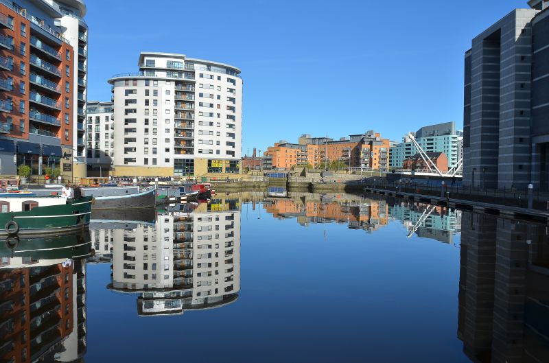
Basin of New Dock, Clarence Dock
GV II
Dock basin. c1850, repaired and restored 1996. Probably by G
Leather. For the Aire and Calder Navigation Company. Coursed
squared gritstone blocks. A rectangular basin approx 100m x
50m; added arms to west and south not included.
This extension to the Cut (qv) was built on the line of a
proposed canal shown on a map of 1834, and was known as the
Potato Dock because of the main cargo handled here. Although
further extensions were added by 1890 transport by canal was
challenged by the new railway system soon after the New Dock
was built.
HISTORY: see Aire and Calder Navigation Leeds Lock, Clarence
Road (qv).
(Smith, P: The Aire and Calder Navigation: 1987-; Rapkin, J: A
map of Leeds, scale 1 inch:320 yards: 1850-).
Listing NGR: SE3083232935
External links are from the relevant listing authority and, where applicable, Wikidata. Wikidata IDs may be related buildings as well as this specific building. If you want to add or update a link, you will need to do so by editing the Wikidata entry.


Other nearby listed buildings
