Approximate Location Map
Large Map »
Latitude: 51.2134 / 51°12'48"N
Longitude: -0.7983 / 0°47'53"W
OS Eastings: 484031
OS Northings: 146707
OS Grid: SU840467
Mapcode National: GBR DB3.WGP
Mapcode Global: VHDY2.3RTP
Plus Code: 9C3X6672+9M
Entry Name: Range of Outbuildings at North East End of Yard to Number 52
Listing Date: 29 December 1972
Grade: II
Source: Historic England
Source ID: 1378281
English Heritage Legacy ID: 290940
ID on this website: 101378281
Location: Farnham, Waverley, Surrey, GU9
County: Surrey
District: Waverley
Civil Parish: Farnham
Built-Up Area: Farnham
Traditional County: Surrey
Lieutenancy Area (Ceremonial County): Surrey
Church of England Parish: Farnham
Church of England Diocese: Guildford
Tagged with: Architectural structure
1099 DOWNING STREET
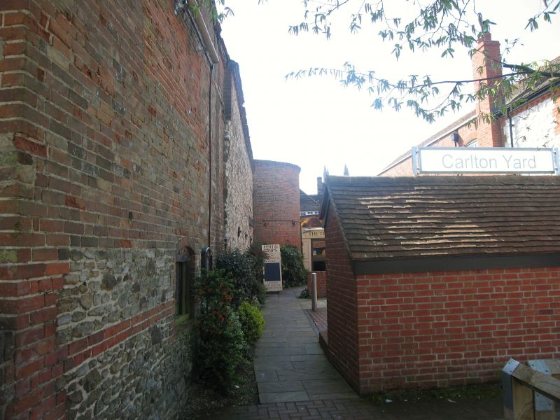
(East Side) Range of outbuildings at north-east end of yard to No 52
SU 8446 111'1 6/70A
II GV
2.
C18 and later. L-shaped. block, the East-West range incororating the remains of a hop kiln belonging to the hop planting family, the Nashs of Farnham. The North-South range with gable end to car park. Side facing down yard to Downing Street with partly open ground floor. Red brick cladding to walls; dentil eaves cornice. Tile gabled roof. Timber framing in north gable end facing on to car park. Red brick in wall to east. South gable end tile-hung. East-West wing: old tile roof; brick dentil eaves cornice. South facing wall of and iron stone rubble; north facing wall of brick and clunch. Rounded brick projection of former kiln at West end.
Graded II for local historical interest and on account of its position of prominence in relation to the car park and to its position in relation to Nos 5o, 51and 52 to other buildings listed in Downing Street. See N- Temple, Farnham Buildings and People", page 84
All the listed buildings on the East Side from 44 to 57A form a group. Nos 50, 51, 51A and 52 and range of outbuildings in north-east corner of yard (yard lies between Nos 51 and 51A) form a smaller group within the main street group.
Listing NGR: SU8403146707
External links are from the relevant listing authority and, where applicable, Wikidata. Wikidata IDs may be related buildings as well as this specific building. If you want to add or update a link, you will need to do so by editing the Wikidata entry.


Other nearby listed buildings
