Approximate Location Map
Large Map »
Latitude: 50.3318 / 50°19'54"N
Longitude: -4.7575 / 4°45'26"W
OS Eastings: 203847
OS Northings: 51625
OS Grid: SX038516
Mapcode National: GBR N1.XFSM
Mapcode Global: FRA 08X5.4CQ
Plus Code: 9C2Q86JV+P2
Entry Name: The Boatshed
Listing Date: 8 November 1999
Grade: II
Source: Historic England
Source ID: 1379460
English Heritage Legacy ID: 478846
ID on this website: 101379460
Location: Charlestown, Cornwall, PL25
County: Cornwall
Civil Parish: St Austell Bay
Built-Up Area: St Austell
Traditional County: Cornwall
Lieutenancy Area (Ceremonial County): Cornwall
Church of England Parish: Charlestown
Church of England Diocese: Truro
Tagged with: Architectural structure
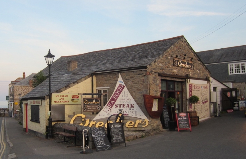
SX 0351 NE ST AUSTELL CHARLESTOWN ROAD, Charlestown
(West side)
868-0/4/10041
The Boatshed
GV II
Fish cellar building, later used as boat house. Early C19 (shown on 1843 tithe map). Killas and granite rubble with granite and brick dressings and timber lintels; painted brick outshut at the front and some brick to left-hand gable; small size rag slate roof with cement mortar grouting sweeping lower over front outshut and at lower pitch over rear extension; brick stack central to rear of outshut. Roughly square plan plus slightly later narrower outshut central to the front and lean-to/outshut at rear. EXTERIOR: single storey; front elevation has small-paned window on either side of the outshut. Lower down on this wall are the beam sockets of a former pilchard-pressing floor. The outshut has a window and a door to the front and a window to the right-hand return. Wide doorway to each return wall of the original building. The doorway of the left-hand return is blocked in 2 phases and there is a loading hatch above. INTERIOR has its original but much-repaired roof structure with nailed collars to the principals. Included as a rare and significant example of its type in Cornwall, part of an important and little altered group in this former fishing and china clay port.
Listing NGR: SX0361152057
External links are from the relevant listing authority and, where applicable, Wikidata. Wikidata IDs may be related buildings as well as this specific building. If you want to add or update a link, you will need to do so by editing the Wikidata entry.


Other nearby listed buildings
