Approximate Location Map
Large Map »
Latitude: 51.2078 / 51°12'28"N
Longitude: -2.6487 / 2°38'55"W
OS Eastings: 354780
OS Northings: 145600
OS Grid: ST547456
Mapcode National: GBR MN.42S0
Mapcode Global: VH89S.1WLZ
Plus Code: 9C3V6952+4G
Entry Name: 3, Queen Street
Listing Date: 31 May 2000
Grade: II
Source: Historic England
Source ID: 1383076
English Heritage Legacy ID: 483494
ID on this website: 101383076
Location: Wells, Somerset, BA5
County: Somerset
District: Mendip
Civil Parish: Wells
Built-Up Area: Wells
Traditional County: Somerset
Lieutenancy Area (Ceremonial County): Somerset
Tagged with: Building
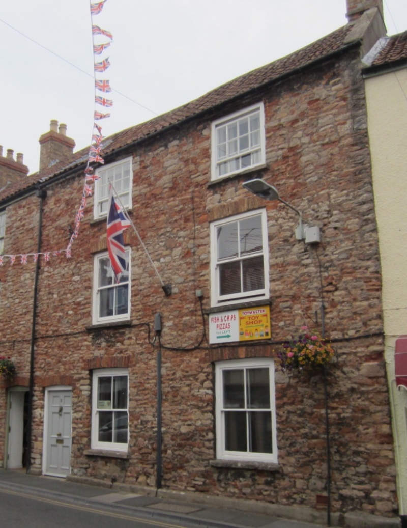
WELLS
ST5445 QUEEN STREET
662-1/7/211 (East side)
No.3
GV II
One of a pair of houses in terrace. Earlier C19. Local stone
coursed rubble with brick arches to openings, clay pantiled
roof between copings, brick chimney stacks.
EXTERIOR: 3 storeys, 2 bays. Sash windows in plain openings,
4-pane to ground and first floors and 12-pane to second floor.
To left of bay 1 the entrance, with a 6-pane door with glazed
top panels set under segmental brick arch.
INTERIOR: not inspected.
Listing NGR: ST5478045600
External links are from the relevant listing authority and, where applicable, Wikidata. Wikidata IDs may be related buildings as well as this specific building. If you want to add or update a link, you will need to do so by editing the Wikidata entry.


Other nearby listed buildings
