Approximate Location Map
Large Map »
Latitude: 53.7032 / 53°42'11"N
Longitude: -1.8995 / 1°53'58"W
OS Eastings: 406732
OS Northings: 422975
OS Grid: SE067229
Mapcode National: GBR HT5M.K7
Mapcode Global: WHB8N.S5NX
Plus Code: 9C5WP432+76
Entry Name: Vaccary Walling
Listing Date: 26 February 2013
Grade: II
Source: Historic England
Source ID: 1405160
ID on this website: 101405160
Location: Norland Town, Calderdale, West Yorkshire, HX6
County: Calderdale
Electoral Ward/Division: Greetland and Stainland
Parish: Non Civil Parish
Traditional County: Yorkshire
Lieutenancy Area (Ceremonial County): West Yorkshire
Church of England Parish: Norland
Church of England Diocese: Leeds
Tagged with: Wall
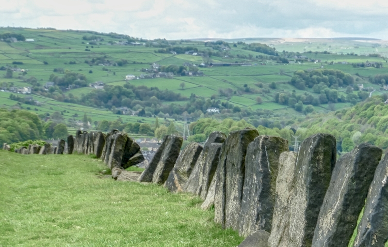
A length of c100m of orthostatic walling of the medieval period, associated with a vaccary or cattle stock farm.
MATERIALS: composed of large orthostats and recumbent stones.
PLAN: the wall runs for just over 100m from east to west, across pasture that slopes down from the south. It forms the north side of a trapezoidal field extending to the Norland Town Road to the south between the Blue Ball Inn and Fallingworth Hall. The wall lies immediately downslope of a pathway visible as a slight hollow-way leading east and south-east towards Lower Old Hall (Grade II* Listed), Norland Town House (Grade II Listed) and Fallingworth Hall (Grade II Listed), all early-mid C17 houses.
Immediately to the west of the wall, are the earthwork remains of the buildings named as ‘Fields’ on earlier maps.
The wall comprises 146 narrow, closely set orthostats, on average 80cms high and 25cm wide and, and a further 27 recumbent stones. There is a break in the wall near the eastern end interpreted as a possible entrance, with a cobbled surface (similar to the cobbled surface of the adjacent hollow-way).
This list entry was subject to a Minor Amendment on 28/06/2017
A vaccary is a term used for a stock farm for cattle, C12 or C13 in origin and generally associated with monastic granges or lands held by lay lords. The cattle were commercially reared in enclosures holding either oxen for sale as draft animals or associated with dairies or cheese houses. They are concentrated in the Pennine area, usually at mid-level pastures. By the later medieval period the use of vaccaries for rearing cattle was becoming less profitable and they were commonly broken down into smaller holdings.
The walling at Norland is in an area of former monastic lands belonging to Fountains Abbey from the early C13. A local place name of ‘Faldyngworth’ (now Fallingworth) mentioned in the 1379 poll tax records has the meaning ‘enclosure for folding livestock’, and a vaccary is recorded nearby in 1339. The 1854 OS 1:10560 map shows the wall as one side of a footpath, one of a series of paths, mostly unwalled, leading from Norland to the south-east towards the River Calder and Sowerby Bridge to the north-west, and forming the north side of a field. At the west end of the wall, beyond a further walled path, a group of buildings is shown on the 1854 map named as 'Fields', perhaps a corruption of 'Folds'; this group of buildings disappear from mapping in the mid-C20 though they remain visible as earthworks.
The medieval vaccary walling at Norland is designated at Grade II for the following principal reason:
* Historic interest: the wall is a rare survival of a regionally distinctive farming practice dating to the medieval period
External links are from the relevant listing authority and, where applicable, Wikidata. Wikidata IDs may be related buildings as well as this specific building. If you want to add or update a link, you will need to do so by editing the Wikidata entry.


Other nearby listed buildings
