Approximate Location Map
Large Map »
Latitude: 52.9424 / 52°56'32"N
Longitude: 1.1147 / 1°6'52"E
OS Eastings: 609382
OS Northings: 342879
OS Grid: TG093428
Mapcode National: GBR T90.DNJ
Mapcode Global: WHLQW.392L
Plus Code: 9F43W4R7+XV
Entry Name: Kelling War Memorial
Listing Date: 8 March 2016
Grade: II
Source: Historic England
Source ID: 1433008
ID on this website: 101433008
Location: Kelling, North Norfolk, NR25
County: Norfolk
District: North Norfolk
Civil Parish: Kelling
Traditional County: Norfolk
Lieutenancy Area (Ceremonial County): Norfolk
Church of England Parish: Kelling St Mary
Church of England Diocese: Norwich
Tagged with: War memorial
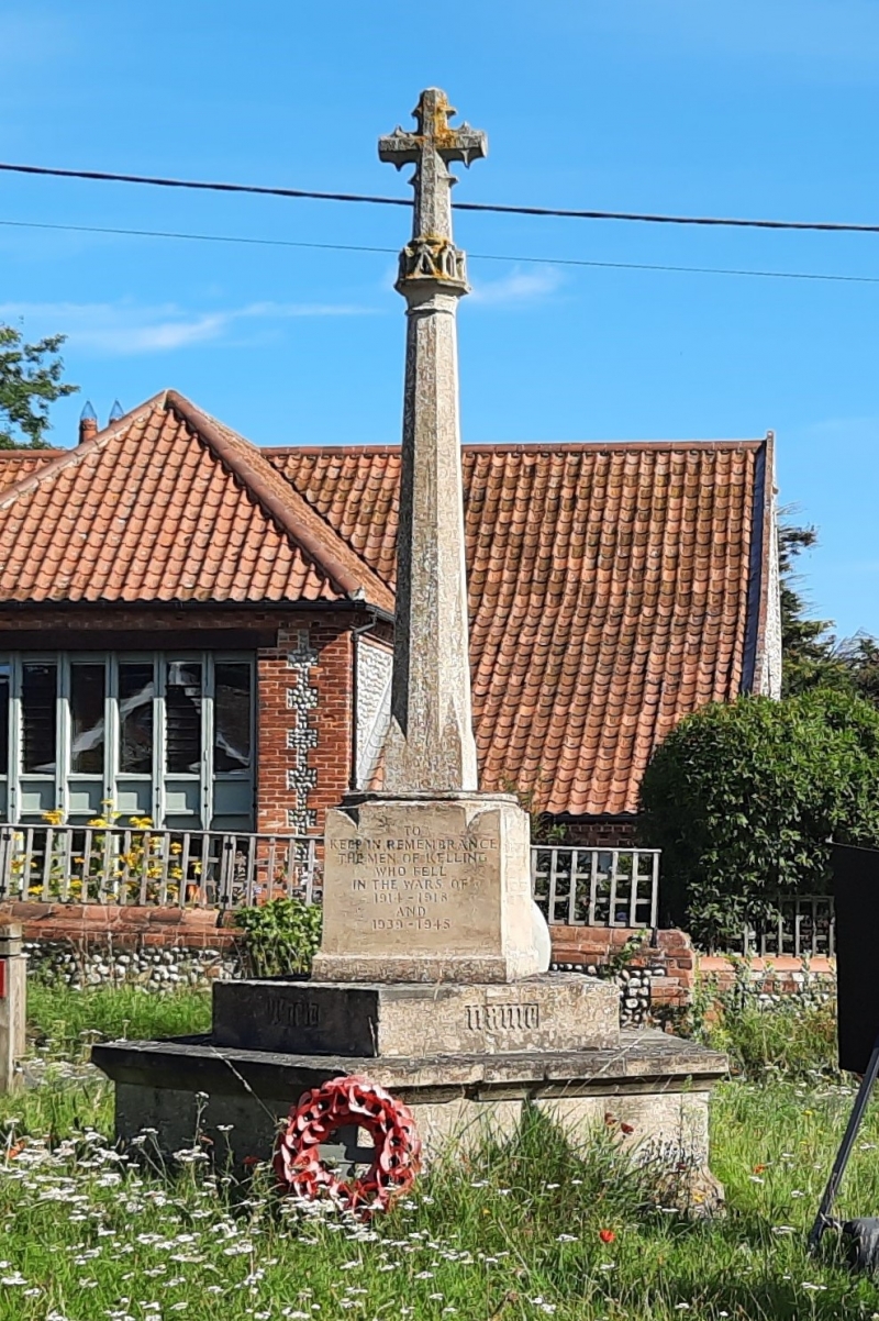
First World War memorial, c.1920, with later additions for the Second World War.
First World War memorial, c.1920, with later additions for the Second World War.
DESCRIPTION: the memorial cross, c. 4 m high, stands on a small green where The Street meets the A149. The stone cross has a small foliate head rising from a crown, set on top of a tapering octagonal shaft. That rises from a fairly small square plinth, which itself is set on a five-sided base of two main stages, the lower stepped out as a shelf for wreaths. The plinth is inscribed TO / KEEP IN REMEMBRANCE / THE MEN OF KELLING / WHO FELL / IN THE WARS OF/ 1914-1918 / AND / 1939–1945. The names of those who fell appear on the other three sides. On the upper stage of the base is inscribed THEIR NAME LIVETH.
The aftermath of the First World War saw the biggest single wave of public commemoration ever with tens of thousands of memorials erected across England. One such memorial was raised at Kelling, in c. 1920, as a permanent testament to the sacrifice made by the members of the local community, who lost their lives in the First and Second World Wars.
Kelling War Memorial, on a small green where The Street meets the A149, is listed at Grade II for the following reasons:
* Historic interest: as an eloquent witness to the tragic impact of world events on the local community, and the sacrifice it made in the conflicts of the C20;
* Design: a short but carefully designed stone cross.
External links are from the relevant listing authority and, where applicable, Wikidata. Wikidata IDs may be related buildings as well as this specific building. If you want to add or update a link, you will need to do so by editing the Wikidata entry.


Other nearby listed buildings
