Approximate Location Map
Large Map »
Latitude: 57.5749 / 57°34'29"N
Longitude: -5.6861 / 5°41'9"W
OS Eastings: 179698
OS Northings: 859854
OS Grid: NG796598
Mapcode National: GBR D8BP.XZ8
Mapcode Global: WH08N.MVJX
Plus Code: 9C9PH8F7+WH
Entry Name: Pier, Lower Diabaig
Listing Name: Lower Diabeg Pier and Store
Listing Date: 31 August 1983
Category: B
Source: Historic Scotland
Source ID: 330708
Historic Scotland Designation Reference: LB433
Building Class: Cultural
ID on this website: 200330708
Location: Applecross
County: Highland
Electoral Ward: Wester Ross, Strathpeffer and Lochalsh
Parish: Applecross
Traditional County: Ross-shire
Tagged with: Pier
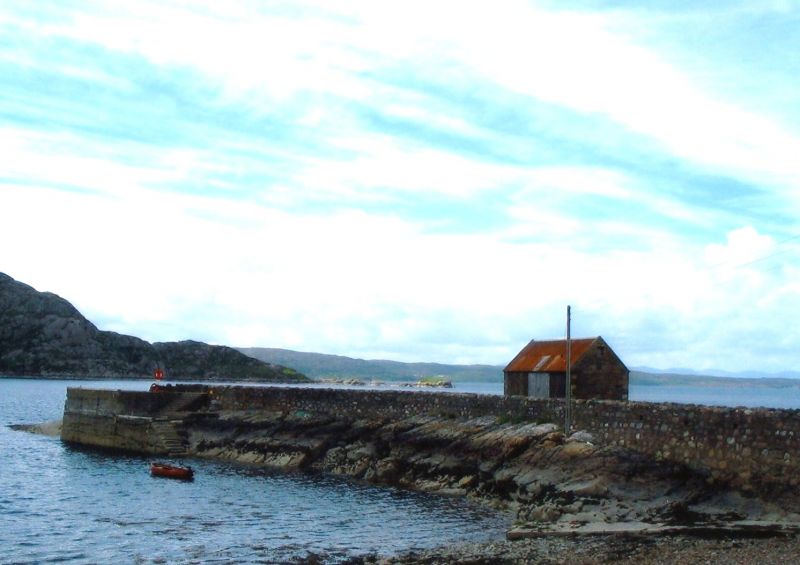
CR Manners, C.E. 1902. Rubble pier built on rocky promontory
with wooden rubbing posts and strakes, linked to shore by
curved causeway with rubble walls. Small single storey,
rubble storey at side of causeway with corrugated iron roof.
Approximately 360' long from shore.
External links are from the relevant listing authority and, where applicable, Wikidata. Wikidata IDs may be related buildings as well as this specific building. If you want to add or update a link, you will need to do so by editing the Wikidata entry.


