Approximate Location Map
Large Map »
Latitude: 57.3733 / 57°22'23"N
Longitude: -4.2027 / 4°12'9"W
OS Eastings: 267644
OS Northings: 833571
OS Grid: NH676335
Mapcode National: GBR H9Z7.CNP
Mapcode Global: WH4GW.DXZY
Plus Code: 9C9Q9QFW+8W
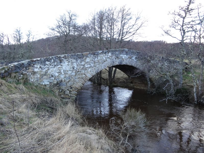
Entry Name: Tordarroch Bridge
Listing Name: Tordarroch Bridge over the Nairn River
Listing Date: 17 April 1986
Category: B
Source: Historic Scotland
Source ID: 332418
Historic Scotland Designation Reference: LB1707
Building Class: Cultural
ID on this website: 200332418
Location: Daviot and Dunlichity
County: Highland
Electoral Ward: Aird and Loch Ness
Parish: Daviot And Dunlichity
Traditional County: Inverness-shire
Tagged with: Bridge Road bridge
Late 18th century, single span rubble bridge with high
dressed rubble arch ring. Dressed rubble parapet rising to
point at centre; splayed approaches.
External links are from the relevant listing authority and, where applicable, Wikidata. Wikidata IDs may be related buildings as well as this specific building. If you want to add or update a link, you will need to do so by editing the Wikidata entry.


Other nearby listed buildings
