Approximate Location Map
Large Map »
Latitude: 57.0934 / 57°5'36"N
Longitude: -4.7453 / 4°44'43"W
OS Eastings: 233766
OS Northings: 803612
OS Grid: NH337036
Mapcode National: GBR G9NZ.93M
Mapcode Global: WH2FQ.2ZL0
Plus Code: 9C9Q37V3+9V
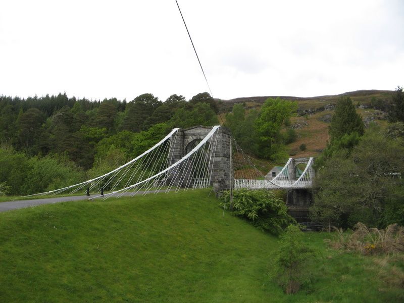
Entry Name: Bridge Of Oich, Oich
Listing Name: Oich, Old Bridge over River Oich
Listing Date: 5 October 1971
Category: A
Source: Historic Scotland
Source ID: 332641
Historic Scotland Designation Reference: LB1872
Building Class: Cultural
Also known as: Victoria Bridge
Oich, Bridge Of Oich
ID on this website: 200332641
Location: Boleskine and Abertarff
County: Highland
Electoral Ward: Caol and Mallaig
Parish: Boleskine And Abertarff
Traditional County: Inverness-shire
Tagged with: Road bridge Steel bridge
Circa 1850, probably James Dredge. Double cantilever chain
suspension bridge; coursed bullfaced rubble battered
pylons linked by round-headed pedimented arches long dry-
stone approach causeway from E; wooden deck to bridge.
Now by-passed by 1932 concrete road bridge. Property in Care.
External links are from the relevant listing authority and, where applicable, Wikidata. Wikidata IDs may be related buildings as well as this specific building. If you want to add or update a link, you will need to do so by editing the Wikidata entry.


Other nearby listed buildings
