Approximate Location Map
Large Map »
Latitude: 56.0331 / 56°1'59"N
Longitude: -3.3554 / 3°21'19"W
OS Eastings: 315635
OS Northings: 683075
OS Grid: NT156830
Mapcode National: GBR 22.RVGX
Mapcode Global: WH6S4.FMD9
Plus Code: 9C8R2JMV+6R
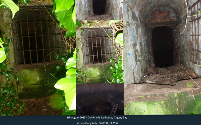
Entry Name: Ice-House, Donibristle House
Listing Name: Donibristle Ice-House
Listing Date: 19 December 1979
Category: B
Source: Historic Scotland
Source ID: 334771
Historic Scotland Designation Reference: LB3651
Building Class: Cultural
ID on this website: 200334771
Location: Dalgety
County: Fife
Electoral Ward: Inverkeithing and Dalgety Bay
Parish: Dalgety
Traditional County: Fife
Tagged with: Icehouse
19th cent. Ashlar front. Stone tunnel leads to brick-lined
chamber.
External links are from the relevant listing authority and, where applicable, Wikidata. Wikidata IDs may be related buildings as well as this specific building. If you want to add or update a link, you will need to do so by editing the Wikidata entry.


Other nearby listed buildings
