Approximate Location Map
Large Map »
Latitude: 54.8658 / 54°51'56"N
Longitude: -3.7984 / 3°47'54"W
OS Eastings: 284674
OS Northings: 553815
OS Grid: NX846538
Mapcode National: GBR 1DX5.GK
Mapcode Global: WH5XD.MYFP
Plus Code: 9C6RV682+8J
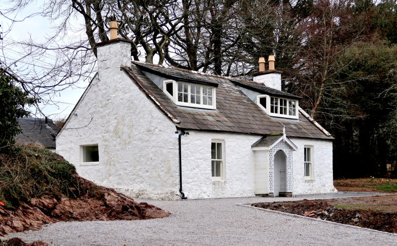
Entry Name: Saltflats, Rockcliffe
Listing Name: Saltflats, Rockcliffe
Listing Date: 4 November 1971
Category: C
Source: Historic Scotland
Source ID: 334849
Historic Scotland Designation Reference: LB3720
Building Class: Cultural
ID on this website: 200334849
Location: Colvend and Southwick
County: Dumfries and Galloway
Electoral Ward: Abbey
Parish: Colvend And Southwick
Traditional County: Kirkcudbrightshire
Tagged with: Cottage
Late 18th century. Single storey painted rubble cottage.
Central doorway with timber gabled porch. Single light
windows to each side. Sash and case with 4-pane glazing.
End skews, coped end stacks, good graded slate roofs. Pair of
small slate roofed dormers with small pane glazing.
External links are from the relevant listing authority and, where applicable, Wikidata. Wikidata IDs may be related buildings as well as this specific building. If you want to add or update a link, you will need to do so by editing the Wikidata entry.


Other nearby listed buildings
