Approximate Location Map
Large Map »
Latitude: 56.3739 / 56°22'26"N
Longitude: -3.9895 / 3°59'22"W
OS Eastings: 277222
OS Northings: 721956
OS Grid: NN772219
Mapcode National: GBR 19.29PX
Mapcode Global: WH4N0.P2F0
Plus Code: 9C8R92F6+H5
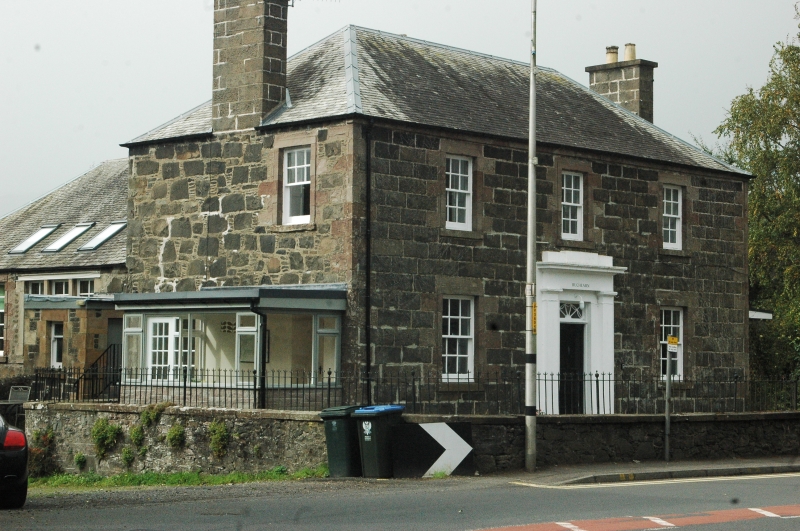
Entry Name: Schoolhouse, Dundas Street, Comrie
Listing Name: Schoolhouse, Dundas Street
Listing Date: 5 October 1971
Category: B
Source: Historic Scotland
Source ID: 336821
Historic Scotland Designation Reference: LB5401
Building Class: Cultural
ID on this website: 200336821
Location: Comrie
County: Perth and Kinross
Electoral Ward: Strathearn
Parish: Comrie
Traditional County: Perthshire
Tagged with: Architectural structure
Peter Comrie, 1832. 2-storey 3-window, anta doorway and small
fanlight. Whin ashlar facade, remainder squared rubble with
pinnings, slated roof, schoolroom wing greatly altered but
still contains former jail in basement.
External links are from the relevant listing authority and, where applicable, Wikidata. Wikidata IDs may be related buildings as well as this specific building. If you want to add or update a link, you will need to do so by editing the Wikidata entry.


Other nearby listed buildings
