Approximate Location Map
Large Map »
Latitude: 56.5696 / 56°34'10"N
Longitude: -3.255 / 3°15'17"W
OS Eastings: 322984
OS Northings: 742668
OS Grid: NO229426
Mapcode National: GBR VB.Q3SR
Mapcode Global: WH6PN.Z45H
Plus Code: 9C8RHP9W+R2
Entry Name: Coupar Grange
Listing Name: Coupar Grange House and Garden
Listing Date: 5 October 1971
Category: B
Source: Historic Scotland
Source ID: 336961
Historic Scotland Designation Reference: LB5492
Building Class: Cultural
ID on this website: 200336961
Location: Bendochy
County: Perth and Kinross
Electoral Ward: Blairgowrie and Glens
Parish: Bendochy
Traditional County: Perthshire
Tagged with: House
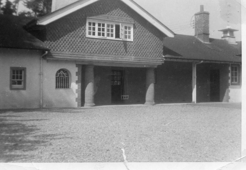
Mainly 2-storey, harled rubble small part half-timber, brick chimney features: asymmetrical simple English jacobean manner. Tiled Roof. Large walled garden in jacobean manner adjoins. James Miller (Glasgow) Archt.,
c.1900.
Ruberoid twin butt roof.
External links are from the relevant listing authority and, where applicable, Wikidata. Wikidata IDs may be related buildings as well as this specific building. If you want to add or update a link, you will need to do so by editing the Wikidata entry.


Other nearby listed buildings
