Approximate Location Map
Large Map »
Latitude: 56.5681 / 56°34'5"N
Longitude: -3.587 / 3°35'13"W
OS Eastings: 302579
OS Northings: 742925
OS Grid: NO025429
Mapcode National: GBR V2.RBKL
Mapcode Global: WH5NC.W52M
Plus Code: 9C8RHC97+76
Entry Name: Dunkeld Lodge And Gate, Dunkeld House, Dunkeld
Listing Name: Dunkeld Lodge, Atholl Street
Listing Date: 5 October 1971
Category: B
Source: Historic Scotland
Source ID: 337079
Historic Scotland Designation Reference: LB5596
Building Class: Cultural
ID on this website: 200337079
Location: Dunkeld and Dowally
County: Perth and Kinross
Electoral Ward: Strathtay
Parish: Dunkeld And Dowally
Traditional County: Perthshire
Tagged with: Architectural structure
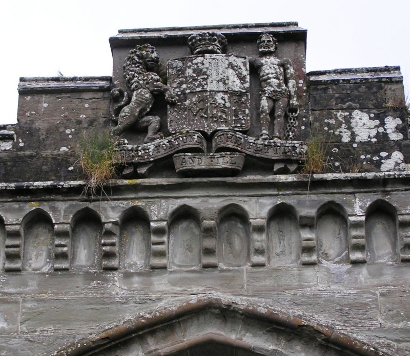
Symmetrical ashalar Tudor, centre arch flanked by single-storey
lodges and rubble screen walls. A. Elliot, archt., 1809
Stables (now a roofless ruin nearby) designed by Elliott
in the same year.
External links are from the relevant listing authority and, where applicable, Wikidata. Wikidata IDs may be related buildings as well as this specific building. If you want to add or update a link, you will need to do so by editing the Wikidata entry.


Other nearby listed buildings
