Approximate Location Map
Large Map »
Latitude: 56.6346 / 56°38'4"N
Longitude: -3.3658 / 3°21'56"W
OS Eastings: 316319
OS Northings: 750027
OS Grid: NO163500
Mapcode National: GBR V8.421D
Mapcode Global: WH6P7.8HHQ
Plus Code: 9C8RJJMM+RM
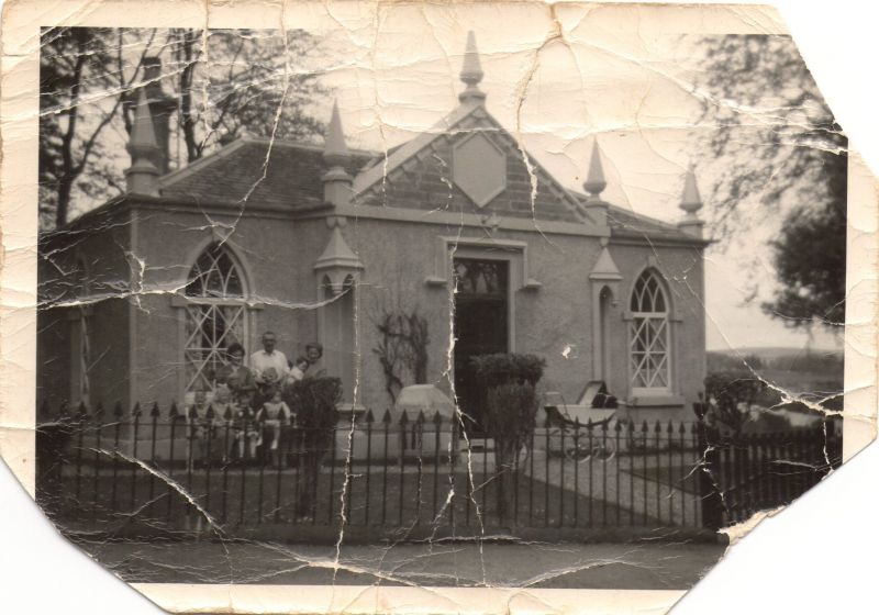
Entry Name: Lodge, Glenericht House
Listing Name: Glenericht Lodge and Gates on Blairgowrie - Bridge of Cally Road
Listing Date: 5 October 1971
Category: B
Source: Historic Scotland
Source ID: 337151
Historic Scotland Designation Reference: LB5666
Building Class: Cultural
ID on this website: 200337151
Location: Blairgowrie
County: Perth and Kinross
Electoral Ward: Blairgowrie and Glens
Parish: Blairgowrie
Traditional County: Perthshire
Tagged with: Architectural structure
Single-storey harled with margins: 'gothick' character;
peind roof: fanciful glazing: centre porch projects with
angle niches; c.i. railings and gates: early 19th cent.
For other listed buildings on Glenericht estate see
Rattray (lwd) parish.
External links are from the relevant listing authority and, where applicable, Wikidata. Wikidata IDs may be related buildings as well as this specific building. If you want to add or update a link, you will need to do so by editing the Wikidata entry.


Other nearby listed buildings
