Approximate Location Map
Large Map »
Latitude: 56.7646 / 56°45'52"N
Longitude: -3.8439 / 3°50'38"W
OS Eastings: 287380
OS Northings: 765186
OS Grid: NN873651
Mapcode National: GBR JBWV.1Y8
Mapcode Global: WH4L4.X7QH
Plus Code: 9C8RQ574+RC
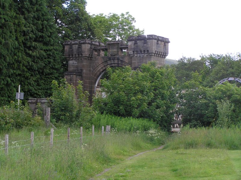
Entry Name: Tilt Viaduct, Blair Atholl
Listing Name: Tilt Railway Viaduct
Listing Date: 5 October 1971
Category: B
Source: Historic Scotland
Source ID: 337634
Historic Scotland Designation Reference: LB6110
Building Class: Cultural
ID on this website: 200337634
Location: Blair Atholl
County: Perth and Kinross
Electoral Ward: Highland
Parish: Blair Atholl
Traditional County: Perthshire
Tagged with: Viaduct Railway viaduct
Single lattice span with arched centre tie. Rubble-built
end arches, crenellated, quatrefoil piercing. Joseph
Mitchell, eng. 1861-2.
External links are from the relevant listing authority and, where applicable, Wikidata. Wikidata IDs may be related buildings as well as this specific building. If you want to add or update a link, you will need to do so by editing the Wikidata entry.


Other nearby listed buildings
