Approximate Location Map
Large Map »
Latitude: 57.2178 / 57°13'4"N
Longitude: -5.4523 / 5°27'8"W
OS Eastings: 191651
OS Northings: 819400
OS Grid: NG916194
Mapcode National: GBR D9XN.3B9
Mapcode Global: WH0BJ.6VX3
Plus Code: 9C9P6G9X+43
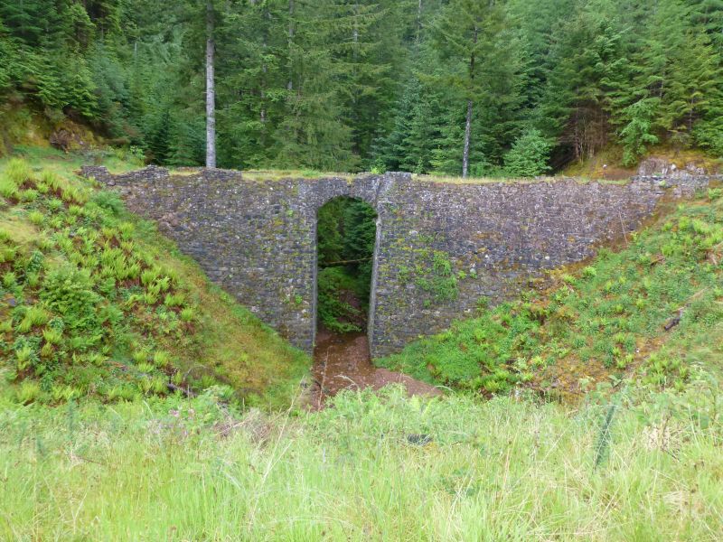
Entry Name: Allt Ratagain Bridge
Listing Name: Bridges Ratagan, Bridge on Shiel Bridge/Glenelg Road (Over Allt Ratagan)
Listing Date: 8 September 1982
Category: B
Source: Historic Scotland
Source ID: 339050
Historic Scotland Designation Reference: LB7221
Building Class: Cultural
ID on this website: 200339050
Location: Glenshiel
County: Highland
Electoral Ward: Wester Ross, Strathpeffer and Lochalsh
Parish: Glenshiel
Traditional County: Ross-shire
Tagged with: Road bridge
Circa 1815. Rubble, single narrow arched bridge and causeway;
overall height approximately 40', bridge 35' high by 10'
wide. Low parapet with sharp bend at SE end and widely
splayed at NW.
Carries section of Parliamentary Road from Glenshiel to
Bernera Barracks, Glenelg and old crossing to Skye at
Kylerhea.
External links are from the relevant listing authority and, where applicable, Wikidata. Wikidata IDs may be related buildings as well as this specific building. If you want to add or update a link, you will need to do so by editing the Wikidata entry.


Other nearby listed buildings
