Approximate Location Map
Large Map »
Latitude: 55.904 / 55°54'14"N
Longitude: -3.46 / 3°27'35"W
OS Eastings: 308816
OS Northings: 668838
OS Grid: NT088688
Mapcode National: GBR 4085.QF
Mapcode Global: WH5RJ.TVKT
Plus Code: 9C7RWG3R+H2
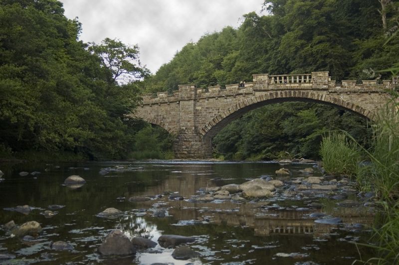
Entry Name: Almondell Bridge
Listing Name: Almondell Bridge, River Almond
Listing Date: 22 January 1971
Category: A
Source: Historic Scotland
Source ID: 339229
Historic Scotland Designation Reference: LB7370
Building Class: Cultural
ID on this website: 200339229
Location: Kirknewton
County: West Lothian
Electoral Ward: East Livingston and East Calder
Parish: Kirknewton
Traditional County: West Lothian
c.1800. Alexander Nasmyth. 1 wide segmental arch with smaller one to N. Coursers. Rock-faced voussoirs. Castellated parapet; slab coping on square piers in centre.
Partly in Uphall, West Lothian. On avenue to Almondell House.
External links are from the relevant listing authority and, where applicable, Wikidata. Wikidata IDs may be related buildings as well as this specific building. If you want to add or update a link, you will need to do so by editing the Wikidata entry.


Other nearby listed buildings
