Approximate Location Map
Large Map »
Latitude: 57.2459 / 57°14'45"N
Longitude: -2.8761 / 2°52'33"W
OS Eastings: 347227
OS Northings: 817579
OS Grid: NJ472175
Mapcode National: GBR M98K.TCN
Mapcode Global: WH7MP.S4ML
Plus Code: 9C9V64WF+8H
Entry Name: Kildrummy Parish Church
Listing Name: Kildrummy Parish Church
Listing Date: 16 April 1971
Category: A
Source: Historic Scotland
Source ID: 341345
Historic Scotland Designation Reference: LB9093
Building Class: Cultural
ID on this website: 200341345
Location: Kildrummy
County: Aberdeenshire
Electoral Ward: Huntly, Strathbogie and Howe of Alford
Parish: Kildrummy
Traditional County: Aberdeenshire
Tagged with: Church building
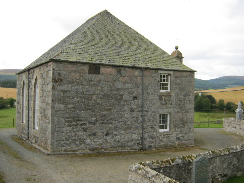
Rectangular with bow front containing staircase and centre
bellcote; high piend roof; 2 large gothic windows on E with
pulpit placed between; rubble-built with pinnings and cherry
cocking, ashlar at bellcote. Horseshoe gallery on square
columns. 1805. Furnishing probably c. 1845/50.
Ecclesiastical building in use as such.
External links are from the relevant listing authority and, where applicable, Wikidata. Wikidata IDs may be related buildings as well as this specific building. If you want to add or update a link, you will need to do so by editing the Wikidata entry.


Other nearby listed buildings
