Approximate Location Map
Large Map »
Latitude: 54.9929 / 54°59'34"N
Longitude: -3.0531 / 3°3'11"W
OS Eastings: 332720
OS Northings: 566989
OS Grid: NY327669
Mapcode National: GBR 7B3P.TZ
Mapcode Global: WH7ZG.2RFQ
Plus Code: 9C6RXWVW+5Q
Entry Name: Sark Bridge, Gretna
Listing Name: Sark Bridge (A75, South Bound Traffic over River Sark)
Listing Date: 4 October 1988
Category: B
Source: Historic Scotland
Source ID: 342313
Historic Scotland Designation Reference: LB9946
Building Class: Cultural
Also known as: Gretna, Sark Bridge
ID on this website: 200342313
Location: Gretna
County: Dumfries and Galloway
Electoral Ward: Annandale East and Eskdale
Parish: Gretna
Traditional County: Dumfriesshire
Tagged with: Road bridge
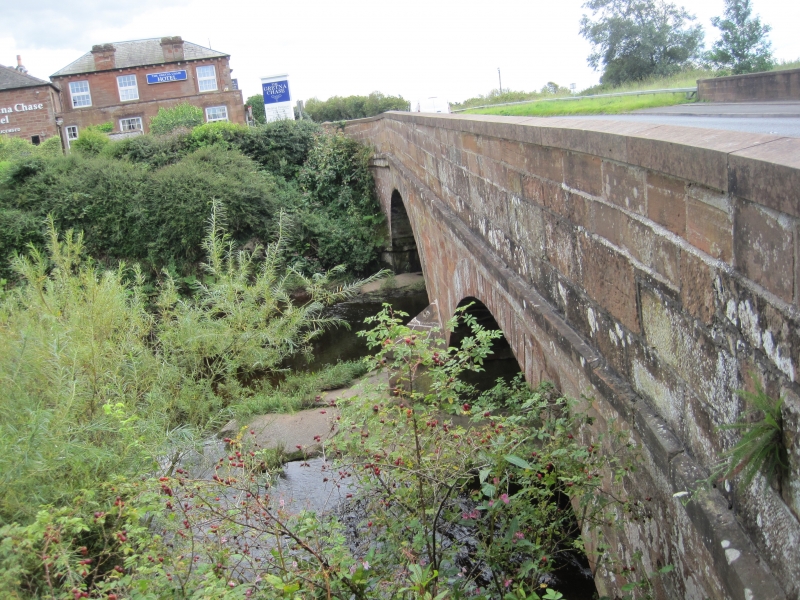
Probably Thomas Telford, circa 1810. Roadbridge, 2
segmental arches over River Sark. All red ashlar, with
rusticated voussoirs; pointed low cutwater either side;
strings below parapets, latter shallow ramped and splayed
at approaches.
Also in Kirkandrews Parish.
External links are from the relevant listing authority and, where applicable, Wikidata. Wikidata IDs may be related buildings as well as this specific building. If you want to add or update a link, you will need to do so by editing the Wikidata entry.


Other nearby listed buildings
