Approximate Location Map
Large Map »
Latitude: 56.2359 / 56°14'9"N
Longitude: -5.0702 / 5°4'12"W
OS Eastings: 209816
OS Northings: 709052
OS Grid: NN098090
Mapcode National: GBR 00.C0Z5
Mapcode Global: WH1JP.2JXC
Plus Code: 9C8P6WPH+8W
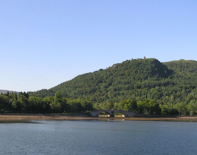
Entry Name: Aray Bridge, Inveraray Castle Estate
Listing Name: Aray Bridge, Mouth of River Aray, Arrochar Road
Listing Date: 20 July 1971
Category: A
Source: Historic Scotland
Source ID: 344136
Historic Scotland Designation Reference: LB11545
Building Class: Cultural
Also known as: Inverarary Bridge
Inveraray Castle Estate, Aray Bridge
ID on this website: 200344136
Location: Inveraray
County: Argyll and Bute
Electoral Ward: Mid Argyll
Parish: Inveraray
Tagged with: Arch bridge Road bridge Stone bridge
1775. Robert Mylne. 2 segmental spans. Rubble; dressed
face-work. Partly balustraded parapet; central spandrel
pierced by oculus; angular pier. Approach walls: weathered
projecting copes; small posts at ends.
De-scheduled 12.02.2001.
Replaced Military Bridge (destroyed by floods 1772)
External links are from the relevant listing authority and, where applicable, Wikidata. Wikidata IDs may be related buildings as well as this specific building. If you want to add or update a link, you will need to do so by editing the Wikidata entry.


Other nearby listed buildings
