Approximate Location Map
Large Map »
Latitude: 56.2934 / 56°17'36"N
Longitude: -5.6512 / 5°39'4"W
OS Eastings: 174161
OS Northings: 717206
OS Grid: NM741172
Mapcode National: GBR DDF2.N84
Mapcode Global: WH0H2.526R
Plus Code: 9C8P78VX+8G
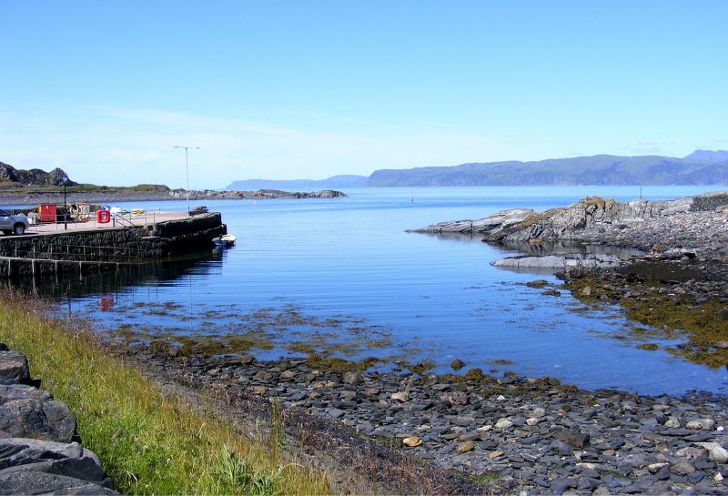
Entry Name: Slate Pier, Ellanbeich, Seil
Listing Name: Ellenbeich Quay at Sgeir Nam Ban and Sea Wall to South
Listing Date: 2 October 1984
Category: B
Source: Historic Scotland
Source ID: 344931
Historic Scotland Designation Reference: LB12201
Building Class: Cultural
ID on this website: 200344931
Location: Kilbrandon and Kilchattan
County: Argyll and Bute
Electoral Ward: Oban North and Lorn
Parish: Kilbrandon And Kilchattan
Traditional County: Argyllshire
Tagged with: Pier
Built circa 1826. Quay, enclosing south side of harbour
inlet; long sea wall extends south. All built of vertically
set rubble slabs. Quay is irregular-plan with parapet at
south, concrete stair to north.
Built for slate-quarrying industry. Second quay formerly at
North end of bay. Now destroyed.
External links are from the relevant listing authority and, where applicable, Wikidata. Wikidata IDs may be related buildings as well as this specific building. If you want to add or update a link, you will need to do so by editing the Wikidata entry.


Other nearby listed buildings
