Approximate Location Map
Large Map »
Latitude: 55.9093 / 55°54'33"N
Longitude: -4.8655 / 4°51'55"W
OS Eastings: 220988
OS Northings: 672171
OS Grid: NS209721
Mapcode National: GBR 30.0QZD
Mapcode Global: WH2MG.7QCR
Plus Code: 9C7QW45M+PR
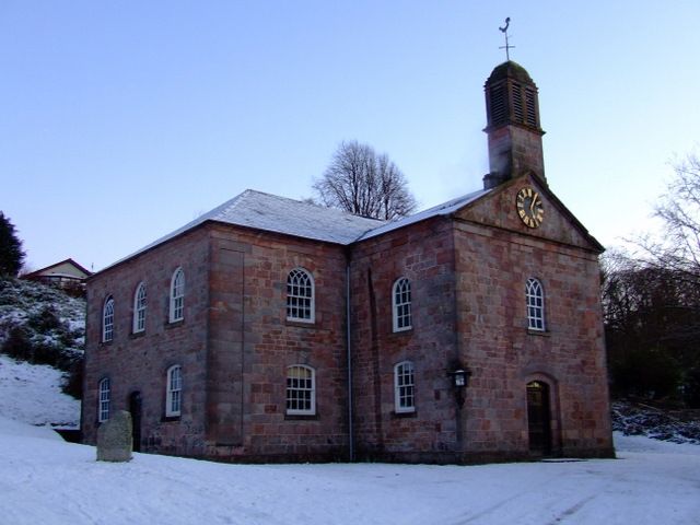
Entry Name: Inverkip Parish Church, Langhouse Road, Inverkip
Listing Name: Inverkip Parish Church. Inverkip.
Listing Date: 10 June 1971
Category: B
Source: Historic Scotland
Source ID: 345265
Historic Scotland Designation Reference: LB12465
Building Class: Cultural
ID on this website: 200345265
Location: Inverkip
County: Inverclyde
Electoral Ward: Inverclyde South West
Parish: Inverkip
Traditional County: Renfrewshire
Tagged with: Church building
2-storey type; simple Renaissance with upper windows
round-headed; open belfry at front gable; (1804-5). clock
on pediment several of windows blocked up, but fenestration
pattern kept in black & white
Ecclesiastical building in use as such.
External links are from the relevant listing authority and, where applicable, Wikidata. Wikidata IDs may be related buildings as well as this specific building. If you want to add or update a link, you will need to do so by editing the Wikidata entry.


Other nearby listed buildings
