Approximate Location Map
Large Map »
Latitude: 55.5605 / 55°33'37"N
Longitude: -4.0147 / 4°0'53"W
OS Eastings: 273026
OS Northings: 631484
OS Grid: NS730314
Mapcode National: GBR 04D4.MK
Mapcode Global: WH4RW.9HGM
Plus Code: 9C7QHX6P+54
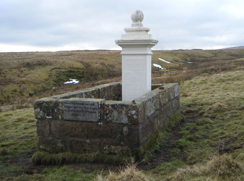
Entry Name: Martyr's Grave, Priesthill
Listing Name: Covenanters' Monument, Priesthill
Listing Date: 6 November 1979
Category: C
Source: Historic Scotland
Source ID: 347725
Historic Scotland Designation Reference: LB14395
Building Class: Cultural
ID on this website: 200347725
Location: Muirkirk
County: East Ayrshire
Electoral Ward: Ballochmyle
Parish: Muirkirk
Traditional County: Ayrshire
Tagged with: Architectural structure
Where John Brown was shot in the presence of his wife and
family by Claverhouse in 1685.
External links are from the relevant listing authority and, where applicable, Wikidata. Wikidata IDs may be related buildings as well as this specific building. If you want to add or update a link, you will need to do so by editing the Wikidata entry.


