Approximate Location Map
Large Map »
Latitude: 59.0189 / 59°1'8"N
Longitude: -2.901 / 2°54'3"W
OS Eastings: 348363
OS Northings: 1015001
OS Grid: HY483150
Mapcode National: GBR M46W.V2R
Mapcode Global: WH7BZ.DKTV
Plus Code: 9CFV239X+HJ
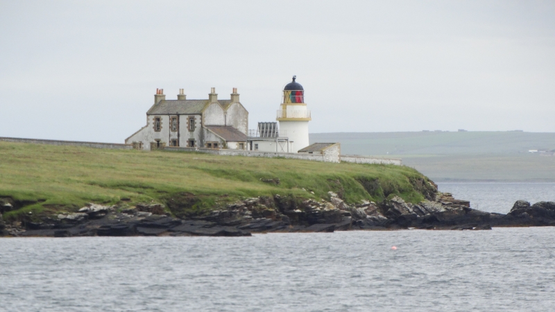
Entry Name: Lighthouse, Helliar Holm, Shapinsay
Listing Name: Shapinsay Lighthouse
Listing Date: 9 December 1977
Category: B
Source: Historic Scotland
Source ID: 352699
Historic Scotland Designation Reference: LB18619
Building Class: Cultural
Also known as: Saeva Ness Lighthouse
Shapinsay Lighthouse
ID on this website: 200352699
Location: Shapinsay
County: Orkney Islands
Electoral Ward: North Isles
Parish: Shapinsay
Traditional County: Orkney
Tagged with: Lighthouse
c.1900. Small circular tower. Lime-washed, KEEPERS' HOUSES:
2 storeys. Double-ridged roof. Lean-to's at ends. BOUNDARY
WALL.
External links are from the relevant listing authority and, where applicable, Wikidata. Wikidata IDs may be related buildings as well as this specific building. If you want to add or update a link, you will need to do so by editing the Wikidata entry.


Other nearby listed buildings
