Approximate Location Map
Large Map »
Latitude: 55.3502 / 55°21'0"N
Longitude: -2.9318 / 2°55'54"W
OS Eastings: 341013
OS Northings: 606632
OS Grid: NT410066
Mapcode National: GBR 76ZK.2Y
Mapcode Global: WH7XR.YS3C
Plus Code: 9C7V9329+37
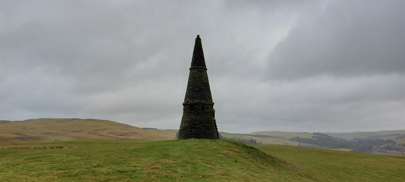
Entry Name: Colterscleuch Monument
Listing Name: Colterscleuch Monument.
Listing Date: 16 March 1971
Category: B
Source: Historic Scotland
Source ID: 354116
Historic Scotland Designation Reference: LB19710
Building Class: Cultural
ID on this website: 200354116
Location: Teviothead
County: Scottish Borders
Electoral Ward: Hawick and Hermitage
Parish: Teviothead
Traditional County: Roxburghshire
Tagged with: Monument
Large cairn on Dryden Knowes erected to the memory of Henry
Scott Riddell.
External links are from the relevant listing authority and, where applicable, Wikidata. Wikidata IDs may be related buildings as well as this specific building. If you want to add or update a link, you will need to do so by editing the Wikidata entry.


Other nearby listed buildings
