Approximate Location Map
Large Map »
Latitude: 56.6241 / 56°37'26"N
Longitude: -3.2318 / 3°13'54"W
OS Eastings: 324516
OS Northings: 748702
OS Grid: NO245487
Mapcode National: GBR VC.6P66
Mapcode Global: WH6P9.BR9S
Plus Code: 9C8RJQF9+J7
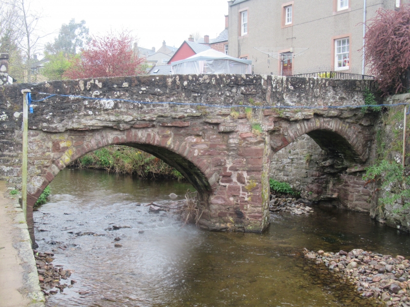
Entry Name: Old Bridge, Alyth
Listing Name: Old Packbridge over Alyth Burn
Listing Date: 5 October 1971
Category: B
Source: Historic Scotland
Source ID: 356263
Historic Scotland Designation Reference: LB21050
Building Class: Cultural
Also known as: Old Packbridge
ID on this website: 200356263
Location: Alyth
County: Perth and Kinross
Town: Alyth
Electoral Ward: Strathmore
Traditional County: Perthshire
Tagged with: Bridge Road bridge
Rebuilt 1674, parapets added early 19th century, heightened
about 1840.
5' 2" wide, 2-segmental arches with cutwaters, rubble-
built, defaced armorial stone.
External links are from the relevant listing authority and, where applicable, Wikidata. Wikidata IDs may be related buildings as well as this specific building. If you want to add or update a link, you will need to do so by editing the Wikidata entry.


Other nearby listed buildings
