Approximate Location Map
Large Map »
Latitude: 55.6251 / 55°37'30"N
Longitude: -3.5212 / 3°31'16"W
OS Eastings: 304308
OS Northings: 637883
OS Grid: NT043378
Mapcode National: GBR 33VD.GD
Mapcode Global: WH5SV.WWD3
Plus Code: 9C7RJFGH+2G
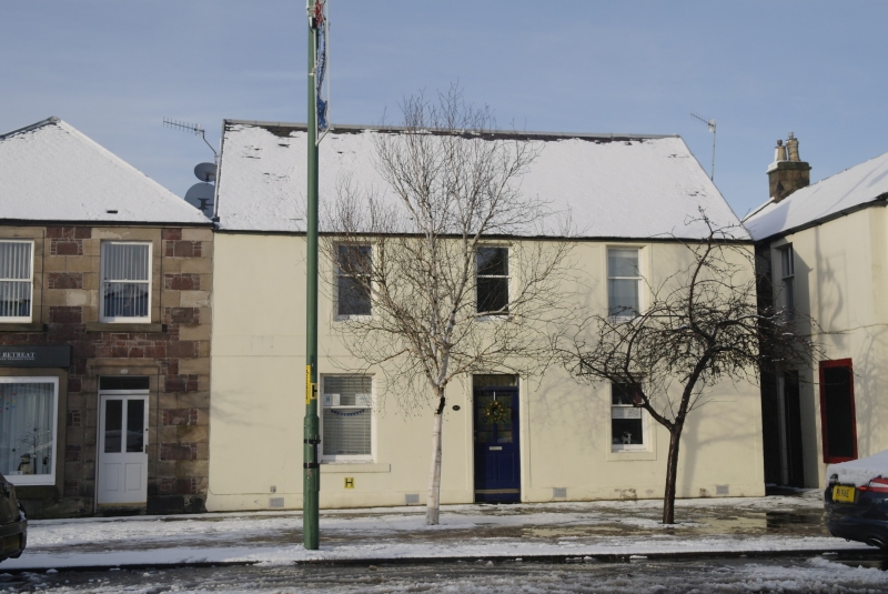
Entry Name: 165 High Street, Biggar
Listing Name: 165 High Street
Listing Date: 7 May 1980
Category: B
Source: Historic Scotland
Source ID: 357753
Historic Scotland Designation Reference: LB22212
Building Class: Cultural
ID on this website: 200357753
Location: Biggar
County: South Lanarkshire
Town: Biggar
Electoral Ward: Clydesdale East
Traditional County: Lanarkshire
Tagged with: Architectural structure
Early 19th century, 2 storeys. Rendered; painted margins;
slate roof; symmetrical 3 window front; base course and band
course. End stacks.
External links are from the relevant listing authority and, where applicable, Wikidata. Wikidata IDs may be related buildings as well as this specific building. If you want to add or update a link, you will need to do so by editing the Wikidata entry.


Other nearby listed buildings
