Approximate Location Map
Large Map »
Latitude: 56.2628 / 56°15'46"N
Longitude: -2.6261 / 2°37'34"W
OS Eastings: 361312
OS Northings: 707990
OS Grid: NO613079
Mapcode National: GBR 2Y.9HXK
Mapcode Global: WH8TL.MVN6
Plus Code: 9C8V797F+4G
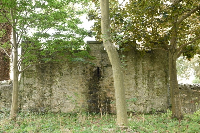
Entry Name: Deadhouse, Churchyard, Crail Parish Church, Marketgate, Crail
Listing Name: Parish Churchyard Deadhouse
Listing Date: 9 May 1972
Category: B
Source: Historic Scotland
Source ID: 358976
Historic Scotland Designation Reference: LB23246
Building Class: Cultural
ID on this website: 200358976
Location: Crail
County: Fife
Town: Crail
Electoral Ward: East Neuk and Landward
Traditional County: Fife
Tagged with: Architectural structure
'Erected for securing the Dead ANN DOM MDCCC - XXVI.' Square droved ashlar, crenellated parapet.
External links are from the relevant listing authority and, where applicable, Wikidata. Wikidata IDs may be related buildings as well as this specific building. If you want to add or update a link, you will need to do so by editing the Wikidata entry.


Other nearby listed buildings
