Approximate Location Map
Large Map »
Latitude: 56.3194 / 56°19'9"N
Longitude: -3.0078 / 3°0'28"W
OS Eastings: 337760
OS Northings: 714570
OS Grid: NO377145
Mapcode National: GBR 2H.5VLB
Mapcode Global: WH7S2.RFW9
Plus Code: 9C8R8X9R+QV
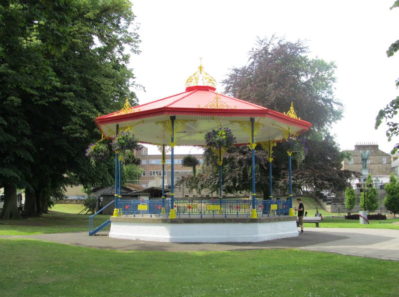
Entry Name: Bandstand, Nicholson Park, Cupar
Listing Name: Bandstand, Hood Park
Listing Date: 23 November 1984
Category: B
Source: Historic Scotland
Source ID: 360179
Historic Scotland Designation Reference: LB24289
Building Class: Cultural
ID on this website: 200360179
Location: Cupar
County: Fife
Town: Cupar
Electoral Ward: Cupar
Traditional County: Fife
Tagged with: Bandstand
Circa 1900. Cast-iron octagon with scroll crown at roof.
External links are from the relevant listing authority and, where applicable, Wikidata. Wikidata IDs may be related buildings as well as this specific building. If you want to add or update a link, you will need to do so by editing the Wikidata entry.


Other nearby listed buildings
