Approximate Location Map
Large Map »
Latitude: 55.0688 / 55°4'7"N
Longitude: -3.6149 / 3°36'53"W
OS Eastings: 296976
OS Northings: 576117
OS Grid: NX969761
Mapcode National: GBR 396T.6S
Mapcode Global: WH5WJ.FVWK
Plus Code: 9C7R399P+G3
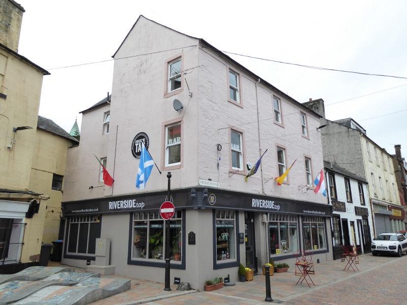
Entry Name: 5, 7, 9 Friars Vennel, Dumfries
Listing Name: 5, 7, 9 Friars Vennel, Corner of Brewery Street
Listing Date: 6 March 1981
Category: C
Source: Historic Scotland
Source ID: 362714
Historic Scotland Designation Reference: LB26189
Building Class: Cultural
ID on this website: 200362714
Location: Dumfries
County: Dumfries and Galloway
Town: Dumfries
Electoral Ward: Nith
Traditional County: Dumfriesshire
Tagged with: Architectural structure
Circa 1800. 3-storey corner building with modern shops
at ground. 3 bays to Friar's Vennel, single bay gable
to Brewery Street. Painted coursed rubble and ashlar
margins. All reglazed, modern glazing at 1st floor, plate
glass sashes at 2nd floor. Eaves/lintel band; tiled
roof.
External links are from the relevant listing authority and, where applicable, Wikidata. Wikidata IDs may be related buildings as well as this specific building. If you want to add or update a link, you will need to do so by editing the Wikidata entry.


Other nearby listed buildings
