Approximate Location Map
Large Map »
Latitude: 55.0703 / 55°4'13"N
Longitude: -3.6119 / 3°36'42"W
OS Eastings: 297171
OS Northings: 576283
OS Grid: NX971762
Mapcode National: GBR 396T.V7
Mapcode Global: WH5WJ.HT9D
Plus Code: 9C7R39CQ+47
Entry Name: 7 1/2 St Andrew Street, Dumfries
Listing Name: 7 and a Half St Andrew Street
Listing Date: 21 August 1987
Category: B
Source: Historic Scotland
Source ID: 362939
Historic Scotland Designation Reference: LB26331
Building Class: Cultural
ID on this website: 200362939
Location: Dumfries
County: Dumfries and Galloway
Town: Dumfries
Electoral Ward: Nith
Traditional County: Dumfriesshire
Tagged with: Architectural structure
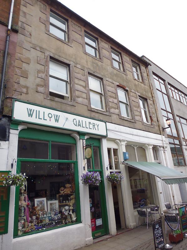
Late 18th century, 3 storeys, 4 bays, with Victorian shop
front. Lined render with red sandstone quoins and dressings.
Ground floor bays (3 equal, 1 narrow) divided by slender
pilasters, shouldered-headed openings, 2-light treatment
above transom at inner bays. Plain fascia. Sash windows to
upper floors. Moulded eaves cornice. Slate roof.
External links are from the relevant listing authority and, where applicable, Wikidata. Wikidata IDs may be related buildings as well as this specific building. If you want to add or update a link, you will need to do so by editing the Wikidata entry.


Other nearby listed buildings
