Approximate Location Map
Large Map »
Latitude: 55.9603 / 55°57'37"N
Longitude: -3.22 / 3°13'12"W
OS Eastings: 323928
OS Northings: 674816
OS Grid: NT239748
Mapcode National: GBR 8HB.7W
Mapcode Global: WH6SL.HGW3
Plus Code: 9C7RXQ6H+4X
Entry Name: St Luke's Parish Church And Hall, East Fettes Avenue, Edinburgh
Listing Name: St Luke's Parish Church (C of S), East Fettes Avenue
Listing Date: 27 October 1965
Category: B
Source: Historic Scotland
Source ID: 364580
Historic Scotland Designation Reference: LB27414
Building Class: Cultural
ID on this website: 200364580
Location: Edinburgh
County: Edinburgh
Town: Edinburgh
Electoral Ward: Inverleith
Traditional County: Midlothian
Tagged with: Church building Church hall
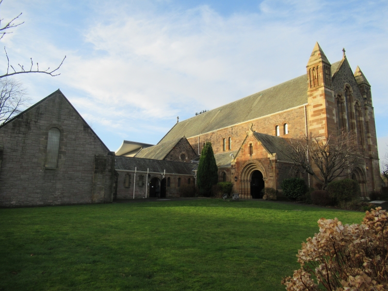
P Macgregor Chalmers, 1907-8. Neo-Romanesque; nave porch,
aisles and clerestory, side chapel, baptistery and apse. Low
link to halls. Interesting interior, giant arches encompass
arcade and clerestory.
Ecclesiastical building in use as such.
External links are from the relevant listing authority and, where applicable, Wikidata. Wikidata IDs may be related buildings as well as this specific building. If you want to add or update a link, you will need to do so by editing the Wikidata entry.


Other nearby listed buildings
