Approximate Location Map
Large Map »
Latitude: 55.9656 / 55°57'56"N
Longitude: -3.1988 / 3°11'55"W
OS Eastings: 325265
OS Northings: 675376
OS Grid: NT252753
Mapcode National: GBR 8M9.K0
Mapcode Global: WH6SL.TBY2
Plus Code: 9C7RXR82+6F
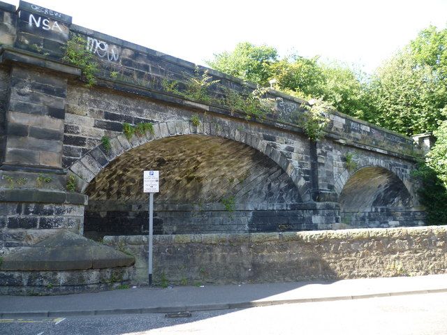
Entry Name: Warriston Bridge, Warriston Road, Edinburgh
Listing Name: Warriston Road Railway Bridge Carrying Railway over Warriston Road
Listing Date: 25 November 1965
Category: B
Source: Historic Scotland
Source ID: 365325
Historic Scotland Designation Reference: LB27954
Building Class: Cultural
ID on this website: 200365325
Location: Edinburgh
County: Edinburgh
Town: Edinburgh
Electoral Ward: Leith Walk
Traditional County: Midlothian
Tagged with: Bridge Railway bridge
Grainger and Miller, Leith and Granton Railway, engineers, 1841-43. 3-segmental skew arches with channelled voussoirs, coped semi-circular ashlar cutwater buttresses with piers dividing arches and band course above, below coped ashlar parapet. Channelled masonry to intrados
The bridge served the former Edinburgh Leith and Newhaven Railway.
External links are from the relevant listing authority and, where applicable, Wikidata. Wikidata IDs may be related buildings as well as this specific building. If you want to add or update a link, you will need to do so by editing the Wikidata entry.


Other nearby listed buildings
