Approximate Location Map
Large Map »
Latitude: 55.9712 / 55°58'16"N
Longitude: -3.2786 / 3°16'43"W
OS Eastings: 320294
OS Northings: 676097
OS Grid: NT202760
Mapcode National: GBR 836.CZ
Mapcode Global: WH6SK.L5ZQ
Plus Code: 9C7RXPCC+FH
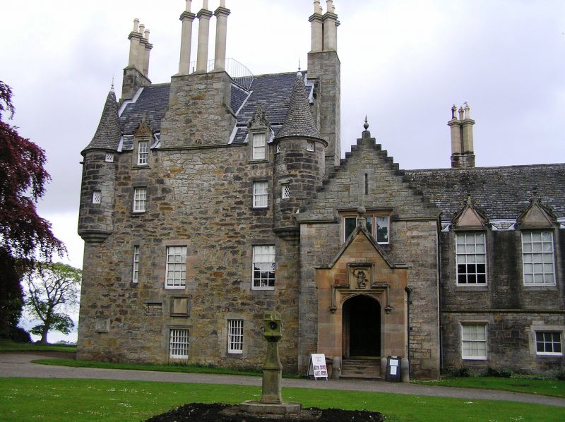
Entry Name: Lauriston Castle, Cramond Road South, Edinburgh
Listing Name: Lauriston Castle Cramond Road South
Listing Date: 14 July 1966
Category: A
Source: Historic Scotland
Source ID: 365437
Historic Scotland Designation Reference: LB28019
Building Class: Cultural
ID on this website: 200365437
Location: Edinburgh
County: Edinburgh
Town: Edinburgh
Electoral Ward: Almond
Traditional County: Midlothian
Tagged with: Tower house Local authority museum
Before 1600. 3-storey and attic turreted rubble-built tower-house, originally T-plan, 40' x 24'. Remodelled, large 2-storey Scots-Tudor addition by Wm Burn 1827: further additions, chiefly two porches and internal improvements 1845, probably W.H. Playfair.
Associations with John Law, founder of The Banque Royal de
France and promoter of the Mississipi scheme.
External links are from the relevant listing authority and, where applicable, Wikidata. Wikidata IDs may be related buildings as well as this specific building. If you want to add or update a link, you will need to do so by editing the Wikidata entry.


Other nearby listed buildings
