Approximate Location Map
Large Map »
Latitude: 55.9594 / 55°57'33"N
Longitude: -3.2121 / 3°12'43"W
OS Eastings: 324423
OS Northings: 674704
OS Grid: NT244747
Mapcode National: GBR 8JC.V6
Mapcode Global: WH6SL.MGNT
Plus Code: 9C7RXQ5Q+Q5
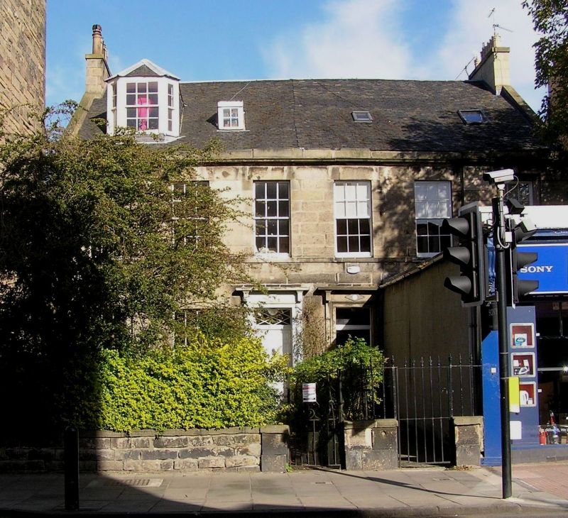
Entry Name: 46 Raeburn Place, Edinburgh
Listing Name: Raeburn Place, 44, 46
Listing Date: 27 October 1965
Category: B
Source: Historic Scotland
Source ID: 369654
Historic Scotland Designation Reference: LB29589
Building Class: Cultural
ID on this website: 200369654
Location: Edinburgh
County: Edinburgh
Town: Edinburgh
Electoral Ward: Inverleith
Traditional County: Midlothian
Tagged with: Architectural structure
Building 1814. 2-storey ashlar, 6-window front, architraved
doorpieces with cornices. No 44 built out as shop.
External links are from the relevant listing authority and, where applicable, Wikidata. Wikidata IDs may be related buildings as well as this specific building. If you want to add or update a link, you will need to do so by editing the Wikidata entry.


Other nearby listed buildings
