Approximate Location Map
Large Map »
Latitude: 55.9483 / 55°56'53"N
Longitude: -3.1947 / 3°11'41"W
OS Eastings: 325485
OS Northings: 673450
OS Grid: NT254734
Mapcode National: GBR 8NH.C6
Mapcode Global: WH6SL.WRWB
Plus Code: 9C7RWRX4+84
Entry Name: Crocket's Land, 91-93 West Bow, Edinburgh
Listing Name: 91 and 93 West Bow, Including Crocket's Land
Listing Date: 21 April 1969
Category: A
Source: Historic Scotland
Source ID: 370560
Historic Scotland Designation Reference: LB29904
Building Class: Cultural
ID on this website: 200370560
Location: Edinburgh
County: Edinburgh
Town: Edinburgh
Electoral Ward: City Centre
Traditional County: Midlothian
Tagged with: Architectural structure
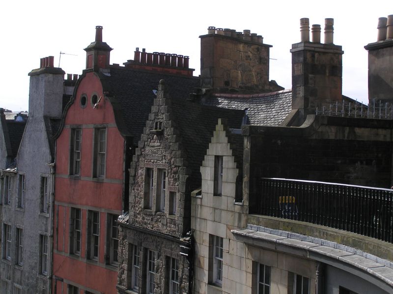
Circa 1705, with later alterations. 4-storey and attic tenement with shop to ground floor. Pink harled with stone margins (painted to ground); random rubble to rear. Stone steps to timber panelled door to flats (Crocket's Land) in corniced and pilastered surround to outer right. Later shopfront to left with inset glazed door, cast-iron gates, flanking windows and dentilled cornice with decorative consoles. Window margins continued horizontally to form decorative panels. Windows of outer left bay blocked. 2 windows in curvilinear gable; 2 oval flight holes above. Gabled rear elevation irregularly fenestrated.
4-pane glazing in timber sash and case windows. Corniced apex chimney stalk with circular can (see Notes). Grey slates; terracotta ridge tiles.
Built circa 1705 by Thomas Crockett of Johnstounburn. Until after the 1827 Improvement Act West Bow was a steep Z-shaped street which climbed from the Grassmarket to Upper Bow at the foot of Castlehill. Most of the old buildings in West Bow were swept away to make room for the northern side of Victoria Street, built to link the Grassmarket with the new George IV Bridge. Before their demolition, Thomas Hamilton, the architect for the scheme, made careful elevational drawings of the buildings. As Hamilton's drawing shows, the first five houses at the lower end of the street on the W remain.
External links are from the relevant listing authority and, where applicable, Wikidata. Wikidata IDs may be related buildings as well as this specific building. If you want to add or update a link, you will need to do so by editing the Wikidata entry.


Other nearby listed buildings
