Approximate Location Map
Large Map »
Latitude: 56.1909 / 56°11'27"N
Longitude: -2.8166 / 2°48'59"W
OS Eastings: 349420
OS Northings: 700112
OS Grid: NO494001
Mapcode National: GBR 2Q.FWPK
Mapcode Global: WH7SR.PNZB
Plus Code: 9C8V55RM+99
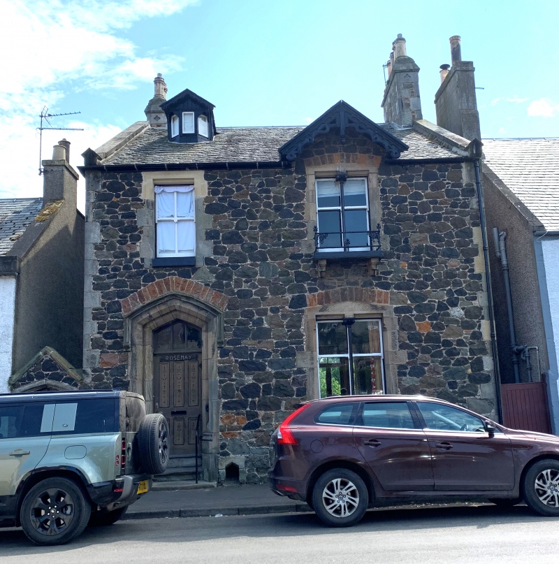
Entry Name: Rosemary, 12 High Street, Elie
Listing Name: Elie Rosemary 12 High Street
Listing Date: 18 August 1972
Category: B
Source: Historic Scotland
Source ID: 372138
Historic Scotland Designation Reference: LB30964
Building Class: Cultural
ID on this website: 200372138
Location: Elie and Earlsferry
County: Fife
Town: Elie And Earlsferry
Electoral Ward: East Neuk and Landward
Traditional County: Fife
Tagged with: Building
Circa 1860, Victorian gothic, well detailed and of picturesque character. Asymmetrical, 2-storey and attic 2-window good random whin rubble, stugged dressings with odd chamfers, moulded depressed arch doorpiece, chip carved wood-work, right-hand windows bipartite with good slim cast iron mullions and bargeboarded gable over, 1st floor window
has balcony; slated, small canted dormer.
External links are from the relevant listing authority and, where applicable, Wikidata. Wikidata IDs may be related buildings as well as this specific building. If you want to add or update a link, you will need to do so by editing the Wikidata entry.


Other nearby listed buildings
