Approximate Location Map
Large Map »
Latitude: 56.1899 / 56°11'23"N
Longitude: -2.824 / 2°49'26"W
OS Eastings: 348960
OS Northings: 700002
OS Grid: NO489000
Mapcode National: GBR 2Q.G1HC
Mapcode Global: WH7SR.LPG3
Plus Code: 9C8V55QG+XC
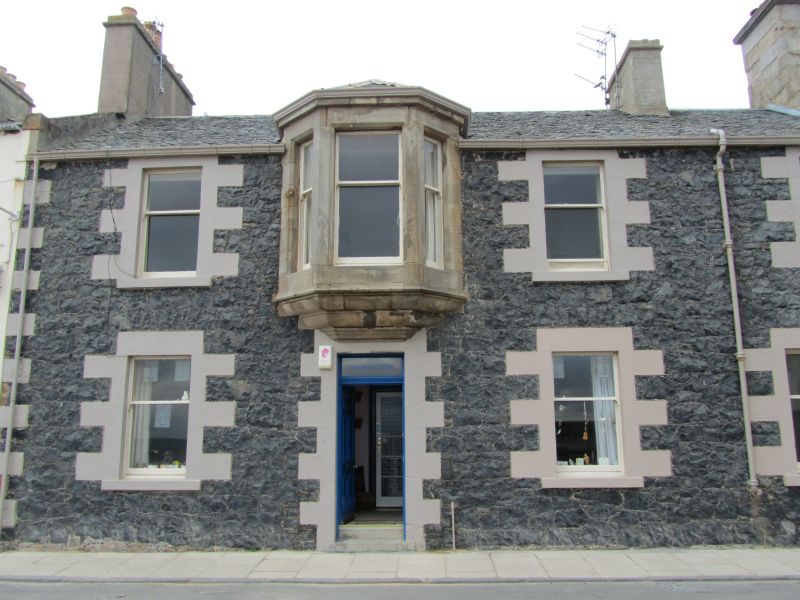
Entry Name: The Blue House, South Street, Elie
Listing Name: The Blue House South Street
Listing Date: 8 January 1980
Category: C
Source: Historic Scotland
Source ID: 372209
Historic Scotland Designation Reference: LB31023
Building Class: Cultural
ID on this website: 200372209
Location: Elie and Earlsferry
County: Fife
Town: Elie And Earlsferry
Electoral Ward: East Neuk and Landward
Traditional County: Fife
Tagged with: House
Early 19th century. Two-storey 4-window with droved dressings, later 1st floor corbelled bay, slated.
External links are from the relevant listing authority and, where applicable, Wikidata. Wikidata IDs may be related buildings as well as this specific building. If you want to add or update a link, you will need to do so by editing the Wikidata entry.


Other nearby listed buildings
