Approximate Location Map
Large Map »
Latitude: 56.1899 / 56°11'23"N
Longitude: -2.8246 / 2°49'28"W
OS Eastings: 348921
OS Northings: 700004
OS Grid: NO489000
Mapcode National: GBR 2Q.FTMB
Mapcode Global: WH7SR.LP53
Plus Code: 9C8V55QG+X5
Entry Name: West House, South Street, Elie
Listing Name: Elie West House South Street
Listing Date: 8 January 1980
Category: B
Source: Historic Scotland
Source ID: 372212
Historic Scotland Designation Reference: LB31026
Building Class: Cultural
ID on this website: 200372212
Location: Elie and Earlsferry
County: Fife
Town: Elie And Earlsferry
Electoral Ward: East Neuk and Landward
Traditional County: Fife
Tagged with: House
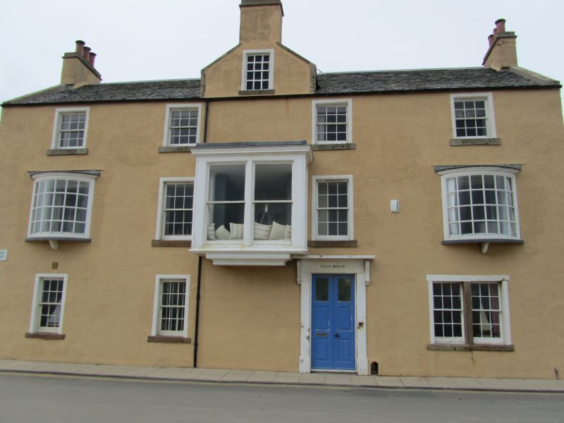
Late 18th century, considerably altered. 3-storey 4-window
harled, consoled doorpiece, central wallhead gable with dummy
window and chimney, heavy late rectangular centre 1st floor
bay flanked by Georgian type oriel bows; slated,
parallel-roofed back wing.
External links are from the relevant listing authority and, where applicable, Wikidata. Wikidata IDs may be related buildings as well as this specific building. If you want to add or update a link, you will need to do so by editing the Wikidata entry.


Other nearby listed buildings
