Approximate Location Map
Large Map »
Latitude: 55.9991 / 55°59'56"N
Longitude: -3.7831 / 3°46'59"W
OS Eastings: 288893
OS Northings: 679897
OS Grid: NS888798
Mapcode National: GBR 1K.V22F
Mapcode Global: WH5QZ.VGQV
Plus Code: 9C7RX6X8+JQ
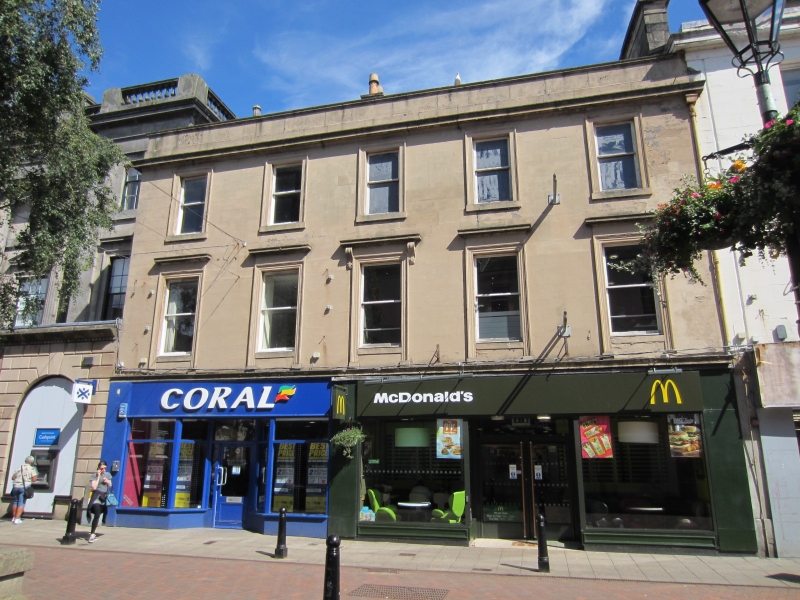
Entry Name: 142, 144, and 146 High Street, Falkirk
Listing Name: 142, 144, 146, 148 High Street, Falkirk
Listing Date: 25 October 1972
Last Amended: 1 June 2023
Category: B
Source: Historic Scotland
Source ID: 372394
Historic Scotland Designation Reference: LB31184
Building Class: Cultural
ID on this website: 200372394
Location: Falkirk
County: Falkirk
Town: Falkirk
Electoral Ward: Falkirk South
Traditional County: Stirlingshire
Tagged with: Architectural structure
Statutory address updated in 2023. Previously listed as '142-146 High Street'.
External links are from the relevant listing authority and, where applicable, Wikidata. Wikidata IDs may be related buildings as well as this specific building. If you want to add or update a link, you will need to do so by editing the Wikidata entry.


Other nearby listed buildings
