Approximate Location Map
Large Map »
Latitude: 57.609 / 57°36'32"N
Longitude: -3.6162 / 3°36'58"W
OS Eastings: 303528
OS Northings: 858812
OS Grid: NJ035588
Mapcode National: GBR K8FM.473
Mapcode Global: WH5HB.F06Q
Plus Code: 9C9RJ95M+HG
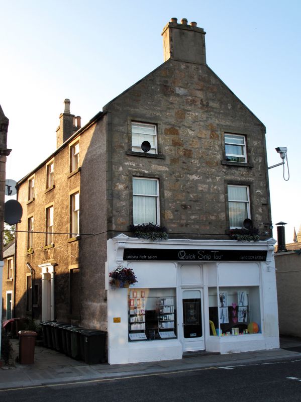
Entry Name: 145 High Street, Forres
Listing Name: 145 High Street (Former Church of Scotland Manse)
Listing Date: 30 March 1983
Category: B
Source: Historic Scotland
Source ID: 372973
Historic Scotland Designation Reference: LB31674
Building Class: Cultural
ID on this website: 200372973
Location: Forres
County: Moray
Town: Forres
Electoral Ward: Forres
Traditional County: Morayshire
Tagged with: Architectural structure Manse
1817-18. 3-storey, 3-bay house. Harled front to close, rubble
gable to street, tooled ashlar margins and angle strips.
Front to close with centre pilastered and corniced doorpiece.
Late 19th century century shopfront at gable. Varied glazing.
End stacks; slate roof.
Originally Forres Parish Manse: good quality shopfront.
Gighouse and stables (now converted to commercial use) lie
to the N.
Former Item 58 (1983 Revised List)
External links are from the relevant listing authority and, where applicable, Wikidata. Wikidata IDs may be related buildings as well as this specific building. If you want to add or update a link, you will need to do so by editing the Wikidata entry.


Other nearby listed buildings
