Approximate Location Map
Large Map »
Latitude: 55.8229 / 55°49'22"N
Longitude: -4.3024 / 4°18'8"W
OS Eastings: 255857
OS Northings: 661251
OS Grid: NS558612
Mapcode National: GBR 3Q.6121
Mapcode Global: WH3P7.WWFY
Plus Code: 9C7QRMFX+52
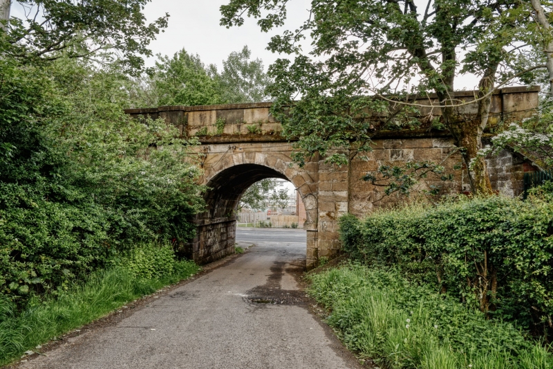
Entry Name: Railway Bridge, Pollokshaws West Station, Pollokshaws Road, Glasgow
Listing Name: Pollokshaws Road, Railway Underbridge to South of Pollockshaws West Station
Listing Date: 17 June 1992
Category: B
Source: Historic Scotland
Source ID: 378128
Historic Scotland Designation Reference: LB33960
Building Class: Cultural
ID on this website: 200378128
Location: Glasgow
County: Glasgow
Town: Glasgow
Electoral Ward: Newlands/Auldburn
Traditional County: Renfrewshire
Tagged with: Railway bridge
Neil Robson, engineer, circa 1847, for Glasgow Barrhead and Neilston Railway. Railway overbridge like a triumphal arch. Rock-faced and polished ashlar, single round archway over driveway, giant pilaster strips.
External links are from the relevant listing authority and, where applicable, Wikidata. Wikidata IDs may be related buildings as well as this specific building. If you want to add or update a link, you will need to do so by editing the Wikidata entry.


Other nearby listed buildings
