Approximate Location Map
Large Map »
Latitude: 55.9604 / 55°57'37"N
Longitude: -4.7762 / 4°46'34"W
OS Eastings: 226796
OS Northings: 677636
OS Grid: NS267776
Mapcode National: GBR 0C.XF0K
Mapcode Global: WH2M9.LGV0
Plus Code: 9C7QX66F+5G
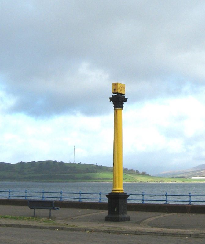
Entry Name: Cast-Iron Navigation Light, Esplanade, Greenock
Listing Name: Esplanade, Cast-Iron Navigation Light
Listing Date: 9 October 1990
Category: B
Source: Historic Scotland
Source ID: 378398
Historic Scotland Designation Reference: LB34179
Building Class: Cultural
ID on this website: 200378398
Location: Greenock
County: Inverclyde
Town: Greenock
Electoral Ward: Inverclyde North
Traditional County: Renfrewshire
Tagged with: Beacon
Navigational light in the form of a Corinthian column on a square pedestal, probably relocated here circa 1860 from the Steamboat Quay (c1810) when the Esplanade was formed with material excavated to form the Albert Dock.
External links are from the relevant listing authority and, where applicable, Wikidata. Wikidata IDs may be related buildings as well as this specific building. If you want to add or update a link, you will need to do so by editing the Wikidata entry.


Other nearby listed buildings
