Approximate Location Map
Large Map »
Latitude: 56.222 / 56°13'19"N
Longitude: -2.706 / 2°42'21"W
OS Eastings: 356317
OS Northings: 703496
OS Grid: NO563034
Mapcode National: GBR 2V.CXPS
Mapcode Global: WH7SM.DWN0
Plus Code: 9C8V67CV+RH
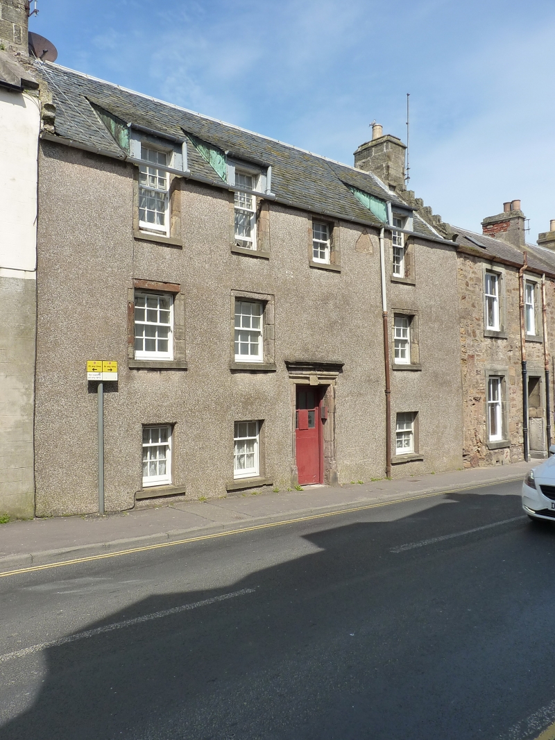
Entry Name: 28 High Street West, Anstruther Wester
Listing Name: 28 High Street Anstruther Wester
Listing Date: 9 May 1972
Category: B
Source: Historic Scotland
Source ID: 380951
Historic Scotland Designation Reference: LB36220
Building Class: Cultural
ID on this website: 200380951
Location: Kilrenny
County: Fife
Town: Kilrenny
Electoral Ward: East Neuk and Landward
Traditional County: Fife
Tagged with: House
Dated 1702. 3-storey and attic, 3 swept dormer heads fine
moulded doorpiece: inset dormerhead panel dated AK 1640.
Slated, moulded chimney copes. Restored 1961, harl
unfortunately dry dash.
External links are from the relevant listing authority and, where applicable, Wikidata. Wikidata IDs may be related buildings as well as this specific building. If you want to add or update a link, you will need to do so by editing the Wikidata entry.


Other nearby listed buildings
