Approximate Location Map
Large Map »
Latitude: 56.1141 / 56°6'50"N
Longitude: -3.1563 / 3°9'22"W
OS Eastings: 328192
OS Northings: 691861
OS Grid: NT281918
Mapcode National: GBR 29.LYNQ
Mapcode Global: WH6RV.HL67
Plus Code: 9C8R4R7V+JF
Entry Name: 54 And 56 Townsend Place, Kirkcaldy
Listing Name: 54 and 56 Townsend Place with Boundary Walls and Railings
Listing Date: 28 January 1971
Category: B
Source: Historic Scotland
Source ID: 381137
Historic Scotland Designation Reference: LB36368
Building Class: Cultural
ID on this website: 200381137
Location: Kirkcaldy
County: Fife
Town: Kirkcaldy
Electoral Ward: Kirkcaldy East
Traditional County: Fife
Tagged with: Architectural structure
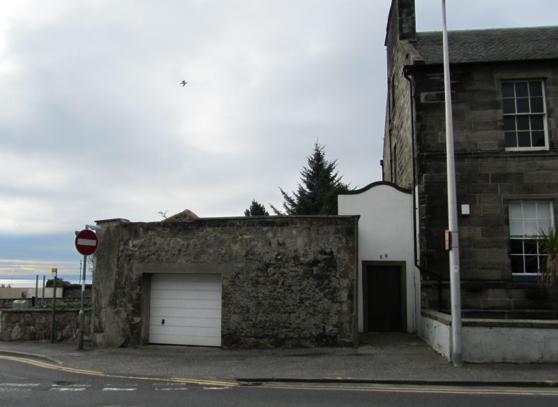
Early 19th century. 2-storey with basement and attic, 3-bay, rectangular-plan flatted dwelling on ground falling to S, and in irregular terrace to W. Dressed ashlar with coursed rubble to sides and rear. Base, cill and eaves courses.
N (PRINCIPAL) ELEVATION: flight of steps with flanking cast-iron railings oversailing basement to centre bay with corniced doorcase with Ionic columns and deep-set panelled timber door with radial-astragalled fanlight; windows in flanking bays to ground floor and basement, and regular fenestration to 1st floor. Small rooflights over bays to centre and right.
S ELEVATION: symmetrical fenestration to 1st floor and piended dormer window to left of centre, (ground floor not visible).
E ELEVATION: gabled bay with window to centre at 1st floor and attic (ground floor not visible). Shaped, harled screen wall with pedestrian door abutting to outer right at ground.
4- and 12-pane glazing patterns in timber sash and case windows. Grey slates. Coped ashlar stacks with cans, ashlar-coped skews and thackstanes; cast-iron downpipes with decorative rainwater hoppers.
INTERIOR: not seen (1996).
BOUNDARY WALLS AND RAILINGS: low saddleback-coped harled walls to S; coped rubble boundary walls elsewhere.
External links are from the relevant listing authority and, where applicable, Wikidata. Wikidata IDs may be related buildings as well as this specific building. If you want to add or update a link, you will need to do so by editing the Wikidata entry.


Other nearby listed buildings
